Day 5

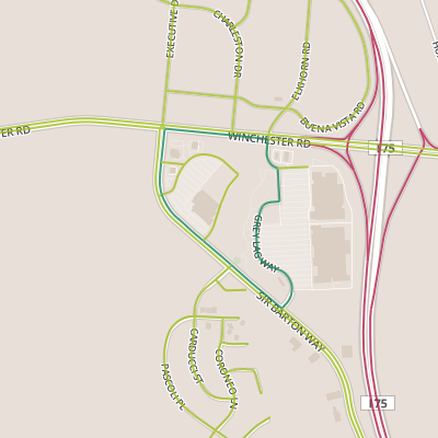
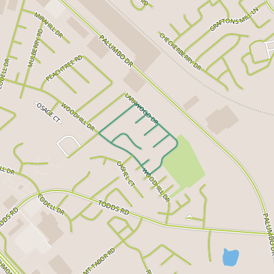
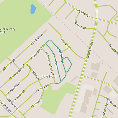
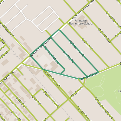
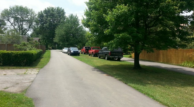
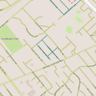
Today’s walk took me to a neighborhood just outside the loop and along Bryan Station.  My first impression of the neighborhood was that it was not parking friendly.  My initial plan had been to park near the outlet of the neighborhood onto Bryant Station, but the streets in the neighborhood are one-way couplets with a grassy median between each side.  Some cars have parked on the grass, but I wanted to avoid this (especially near the front, where the median has recently been reseeded.  I parked nearby and walked into the neighborhood.

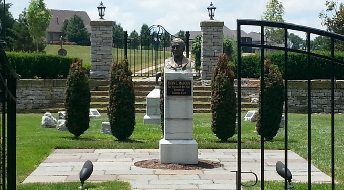
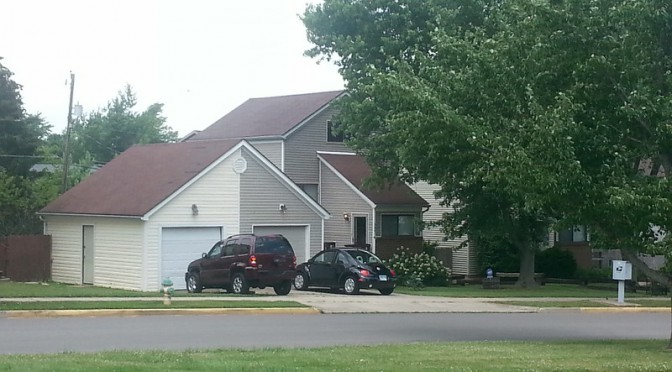
I was somewhat surprised by the large houses, a few of which were undergoing significant work.   The housing stock seems to reflect a variety of styles and to have been constructed over a wide period of time.  The yards tended to the wild side, but perhaps a cultivated wild.  I was also pleasantly surprised that despite the lack of sidewalks, the neighborhood felt quite walkable, and I suspect the medians on most of these streets added to a sense of street safety.

When I pass through a neighborhood, I try to get a feel for its inhabitants, and in Lexington in particular, a couple of things stand out to me.  I very much notice neighborhoods without sidewalks (as you might imagine), and I also notice (when it is trash day) when neighborhoods have private trash service.  I tend to see both of these attributes as pointing to a more politically right-leaning demographic.  Favoring private services over public ones is a fairly straightforward expression of limited government, and sidewalks could be seen as taking private land for public good.  In older neighborhoods, I suppose its best to be cautious of this.  After walking through this neighborhood, I had a sense that it was more likely a little left leaning.  It would be interesting to take another look when the yard sides come out this fall!

Day 4

Today’s walk provides a lot of support that my motivation for walking every street to find the hidden gems is in fact worthwhile.  Certainly, I expect that some walks are not going to be terribly interesting, and I scheduled a pilot walk in Hamburg including part of it’s northern boundary on Winchester Road simply to see how bad it would be.  Instead, I turned out some of the most interesting things to date.

I parked in a far corner of a parking lot and headed towards Sir Barton, then along Winchester Road, basically along a culvert.  Nearing Grey Lag, I saw a sidewalk appear, leading from the shopping area along Sir Barton and Winchester to a park in the middle of the block.  If one slipped off the path, however, you would discover a trail leading into the woods.

Old foundation wall
Old foundation wall

Following the trail for a short distance uncovered an old foundation wall, and the path continued from there.  I headed back to my scheduled route, but found the allure of the hidden park too much to ignore, so I spent some extra time walking through it as well.  I was more than a little surprised to find out that the park was centered on a horse cemetery, part of Hamburg Farms.

I headed back to my route and eventually passed the front of the horse cemetery again on the Sir Barton side, where it is clearly labeled. This may well be something that long-time Lexingtonians are well aware of, but I was surprised to find that this horse cemetery was in plain sight along a street I’ve driven down dozens of times.

I thought this walk nicely demonstrated a couple of points, one about the hidden gems of the urban fabric and another about the impact of pace on what we can allow ourselves to see in our built environment.

Day 3

Day 3 of my pilot walking took me to the area around Woodhill Park and (much like Day 2) near the industrial corridor along the  RJ Corman tracks.  Today’s walk took me through portions of two distinct neighborhoods with apparently different periods of construction, though both neighborhoods were typically suburban.  Today was my first experience with long cul-de-sacs, something that I’m finding are present in many of the neighborhoods built in the last five decades or so.  Cul-de-sacs are an interesting problem for me as someone who is in essence just taking a stroll through a neighborhood.  If I’m trying to get somewhere, I’m definitely going to avoid cul-de-sacs, but even if I’m strolling, my instinct is to avoid them because, well, it’s just awkward to walk down a street, then turn around and walk back.  But this is exactly what I did, several times. today.  Cul-de-sacs are intentional, a way to keep traffic and strangers off a street.  They feel safe to walk on, but I think that someday, someone is going to ask me what I’m doing!

My favorite aspect of today’s walk were the set of homes along Larkwood facing the park, pairs of detached houses with combined garages.

Day 2

Day 2 route

Today’s walk was through the mid-century Idle Hour neighborhood. The neighborhood is bounded roughly by New Circle Road, an industrial area near the RJ Corman tracks, Richmond Road and the Idle Hour country club. The neighborhood is buffered from New Circle Road by Idle Hour park, and it was from here that I started the walk. Though the houses seem to be from the 1950’s, they usually seem to feature cars or carports. I always wonder what these neighborhoods must have seemed like when they were new, but it seems reasonable to imagine an air of optimism, especially in the coming half-century of car culture. On this day, it was fairly quiet, though the occasional car did speed by especially on the main feeders. Will Fant was dominated by duplexes and apartments, and here you could hear children playing.

Typical mid-century architecture

Overall, though, this neighborhood was rough around the edges. Certain things are always troubling to me in neighborhoods like this. Usually, it’s something along the lines of streets that aren’t maintained (i.e., repaved) as well as they might be in a nicer area. I did notice at one intersection, the “zebra” crosswalk marking had been scraped off. I’d really like to know the story behind that.

Day 1

Day 1 routeHere we go!  Today’s walk starts at Castlewood Park, familiar ground for me and, fittingly, the place where I developed the idea of walking all of Lexington.  Crossing the street to walk down Bryan was exhilarating.  It did not disappoint.  There was a lot to observe on this walk, which consisted of segments of Bryan along the Castlewood Park perimeter and North Limestone as well as Loudon and three neighborhood street (Wittland, Glenn and Burnett) that (for the most part) run between Bryan and Limestone.  Castlewood Park has the Lexington Art League and North Limestone consists of a commercial district with a funky mix (including BroCoLoco and a used restaurant equipment store) that appears to be doing fine.  I would have expected the artsiness to bleed into the neighborhood but it did not seem to have an overwhelming impact on these blocks, which generally felt accessible. A father and son painting the exterior of their house only added to the homeyness.  The neighborhood did feature a community garden.  And a classic car logo encased in the sidewalk!