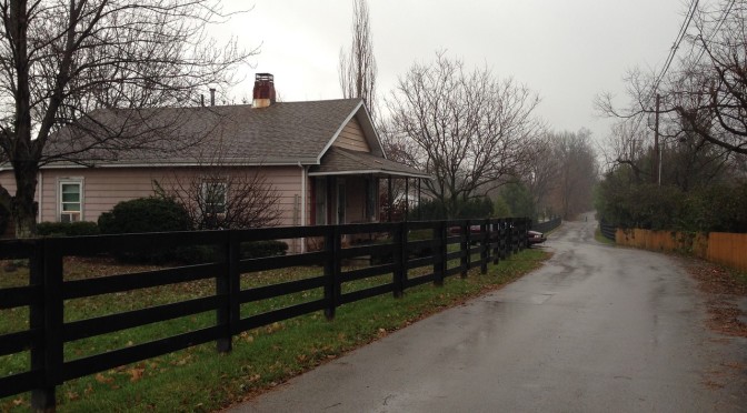
Today’s walk was in the Masterston Station neighborhood. This generally felt like a pretty typical Ball Homes neighborhood from the last couple of decades (there are a few traits that seem to typify Ball Homes neighborhoods, but the giveaway here was the sign at the neighborhood entrance). The oldest homes here seems to be six years old or so, and there are still some platted lots where houses have not yet been built.
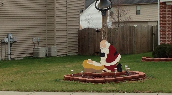
The outstanding feature of the portion of the neighborhood I walked through today was it’s numerous manger scenes, which varied from traditional to more lighthearted. There were plenty of less overtly religious light displays as well, but it was pretty clear that residents here in general take Christmas pretty seriously. I did get a chuckle out of the Santa and baby Jesus scene, a merging of traditions I guess.
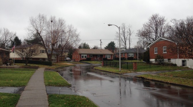
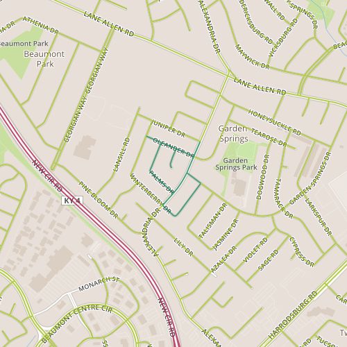
Today, I visited the Garden Springs neighborhood, along Alexandria near Harrodsburg Road, a 1960’s neighborhood with simple ranch styles.
In the first few weeks I spent walking, it was easy to make imperfect comparisons between the unfamiliar neighborhoods I was walking through and neighborhoods I am more familiar with, generally in other cities. Over time, I’ve became less compelled to do this. This stretch of Alexandria, though, reminded me so much of the street we lived on before we moved to Lexington that it’s impossible to not make comparisons. Both streets are wide, 40 feet give or take a foot or so. Both are fast for residential streets (Alexandria’s 35 mile per hour speed limit, like most of Lexington’s speed limits, is probably about 5 mph faster than a comparable street in the Denver area), and both probably carry similar traffic loads. The sidewalks on Alexandria are far nicer; the inclusion of a planting strip makes it much nicer to walk down.
Alexandria near Garden Springs.
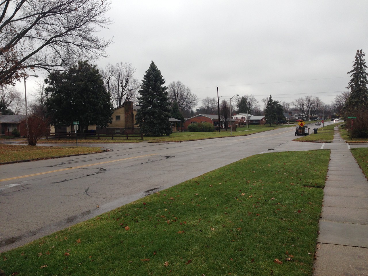
But Alexandria feels wider despite the fact it is almost exactly the same width. The perception that this street is wider makes it more of a barrier. (I felt comfortable strolling across the street to talk to a neighbor, which seems less likely here.) I don’t know what exactly makes my old street feel less like a barrier than Alexandria; a recently added bike lane may have helped. It may be that the height of houses relative to their distance from each other across the street contributes as well, as houses in my old neighborhood are slightly taller, and somewhat closer, 100-110 feet apart across the street versus 130 feet here.
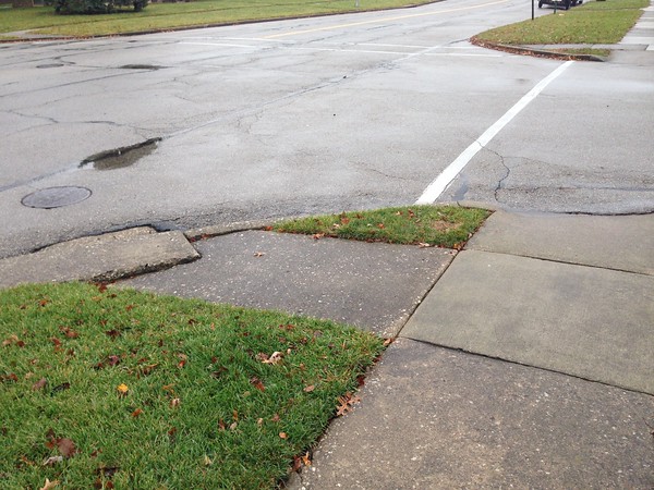
Sidewalks cross at intersections, providing separate crossings for each travel direction.
And of course, the sidewalks on opposite sides are further apart because of the planting strip. These seem like small differences, but the perceptual difference is very clear.
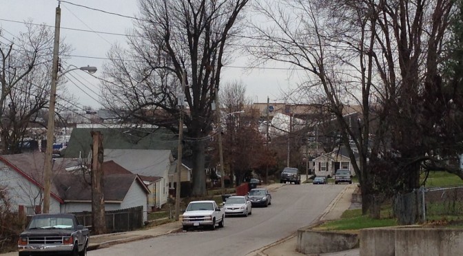
Today’s walk required a short walk across New Circle Road on Winchester and the area immediately southwest of the interchange, which is one of the busiest interchanges in Lexington. The areas adjacent to the interchange are commercial and include a couple of self-storage facilities on James and a newer office building. Ashton and Forston make up a hidden residential neighborhood, very similar to the neighboring area I passed through on Day 23. The homes here are modest, generally 1940’s vintage though with some newer houses mixed in and some addition room for further infill. This is another neighborhood that isn’t self-conscious, and though this can sometimes result in some rough edges, this area exuded a sense of pride. There is probably a long list of housing qualities, objective and subjective, that you could measure–size and age to name a few. This area outperforms expectations for upkeep based on size, age, construction.
Looking east along Winchester toward New Circle Road interchange
Winchester and New Circle Road really isolate this area perceptually; from a car, it’s easy to pass without thinking of the side streets; on foot, crossing either Winchester or New Circle is an adventure. With the retail businesses on the north side of Winchester, it would be nice to see this stretch get some pedestrian improvements.
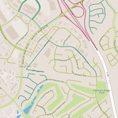
Today’s walk encompassed some of the larger commercial properties on the south side of the Hamburg area, along Bryant and Pleasant Ridge, as well as a portion of the Timber Creek neighborhood near Pleasant Ridge park, as well as a portion of the Brighton East “rail trail” connecting those two pieces.
The portion along Bryant is generally warehouse-sized commercial–large gyms, a furniture outlet. There are also a few odd homes in here, holdouts, perhaps. Some of these lots front the newer mixed-used trail; a sign at the entrance to the trail (the “elbow” of Bryant) states “authorized vehicles only” are allowed to pass. Apparently homeowners are authorized! The trail itself is part of the first “Rails to Trails” project in Lexington, completed in 2006. These projects seek to convert existing railroad right-of-ways to mixed-used trails. Currently there are a lot of short segments like this, but a little investigation shows that there are plans in place to extend and connect the trails.
Concrete Retaining Wall along Pleasant Ridge
I was excited about this walk, mainly for the chance to incorporate a trail–perhaps a little too eager to take it on. I thought I’d caught a break in the rainy weather and would have a chance to walk in relatively light rain; instead, I spent most of the walk in steady downpour. One of the neat things about this process is that I’m rediscovering walking the joys of walking in all sorts of weather, but this really depends on being dressed appropriately, and today I was not. This will serve as a reminder to bring a raincoat. At any rate, by the time I reached the residential segment of the walk, I was less focused on observation and more focused on moving quickly. This stretch consists mainly of the back of houses, blank space that often occurs in suburban neighborhoods along feeder routes like Pleasant Ridge that serve to channel traffic out of neighborhoods to larger streets. This kind of space is usually neglected, but here the area was clean and well maintained. I think some decoration along a short concrete retaining wall could add something.
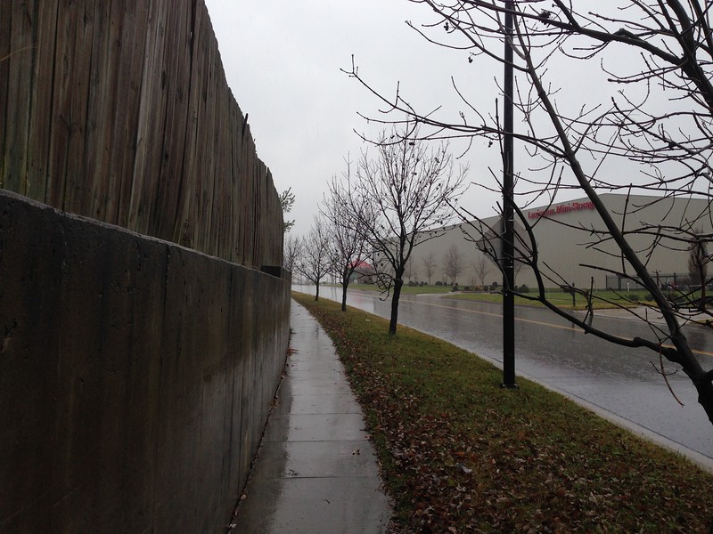
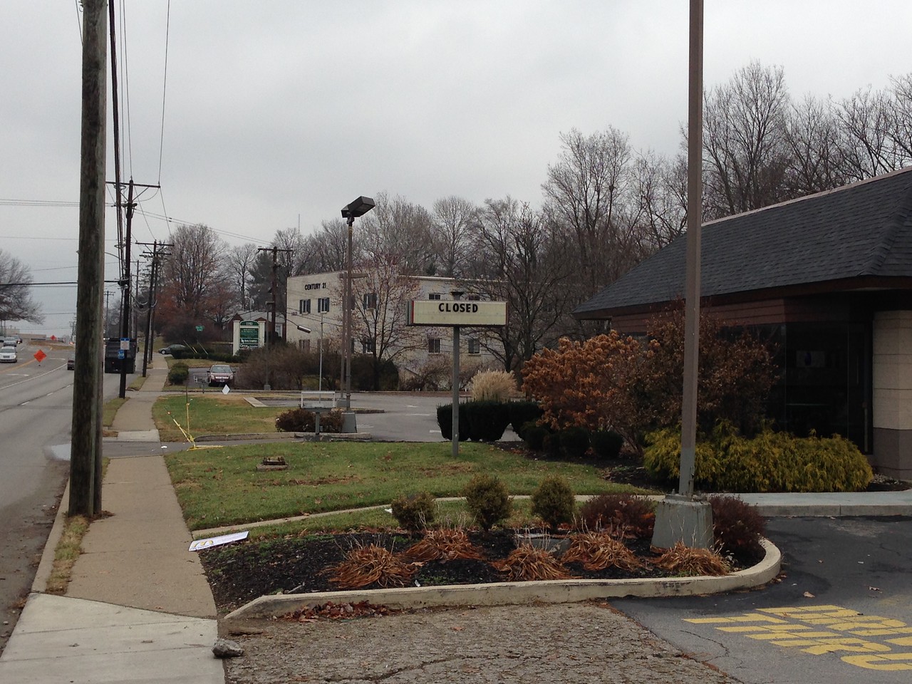
It’s hard to fix mistakes written in concrete. I came across the words “No More” scrawled in relatively fresh concrete in the drive way of some new structures along Mitchell and behind Harrodsburg near Lane Allen, a 1950’s era commercial district undergoing significant change. One wonders…no more what? Is this a response to the buildings, the construction itself–no more McDonald’s? Or to something else, a protest against police brutality or a complaint about algebra homework? The mystery is tantalizing, and should grow as it gets older.
The old McDonald’s is closed.
Jack White of the Raconteurs sings “You wrote our names down on the sidewalk/then the rain came and washed ’em off/So we should write ’em again on wet cement/so maybe people a long time from now will know what we meant.” And while he wasn’t talking about streets and buildings, it’s interesting to try to put that meaning to it. The messages we put in concrete today, in the form of roads and buildings, will be with us for generations. Walking through this 1950’s neighborhood, it’s tough not to think about how society’s preferences–choices made 60 years ago–are reflected in the streetscape, and wonder what the new structures say about us.
 Today’s walk was in the Masterston Station neighborhood. This generally felt like a pretty typical Ball Homes neighborhood from the last couple of decades (there are a few traits that seem to typify Ball Homes neighborhoods, but the giveaway here was the sign at the neighborhood entrance). The oldest homes here seems to be six years old or so, and there are still some platted lots where houses have not yet been built.