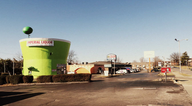
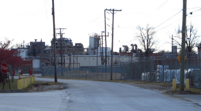
I know you’ve always wanted to know what, exactly, is down Zesta Place. Today’s walk was an exploration of the industrial area surrounding the Jif peanut butter plant on Winchester Road including the intriguingly-named Zesta. (Did someone intentionally name a street that runs by a peanut butter plant after a cracker?)
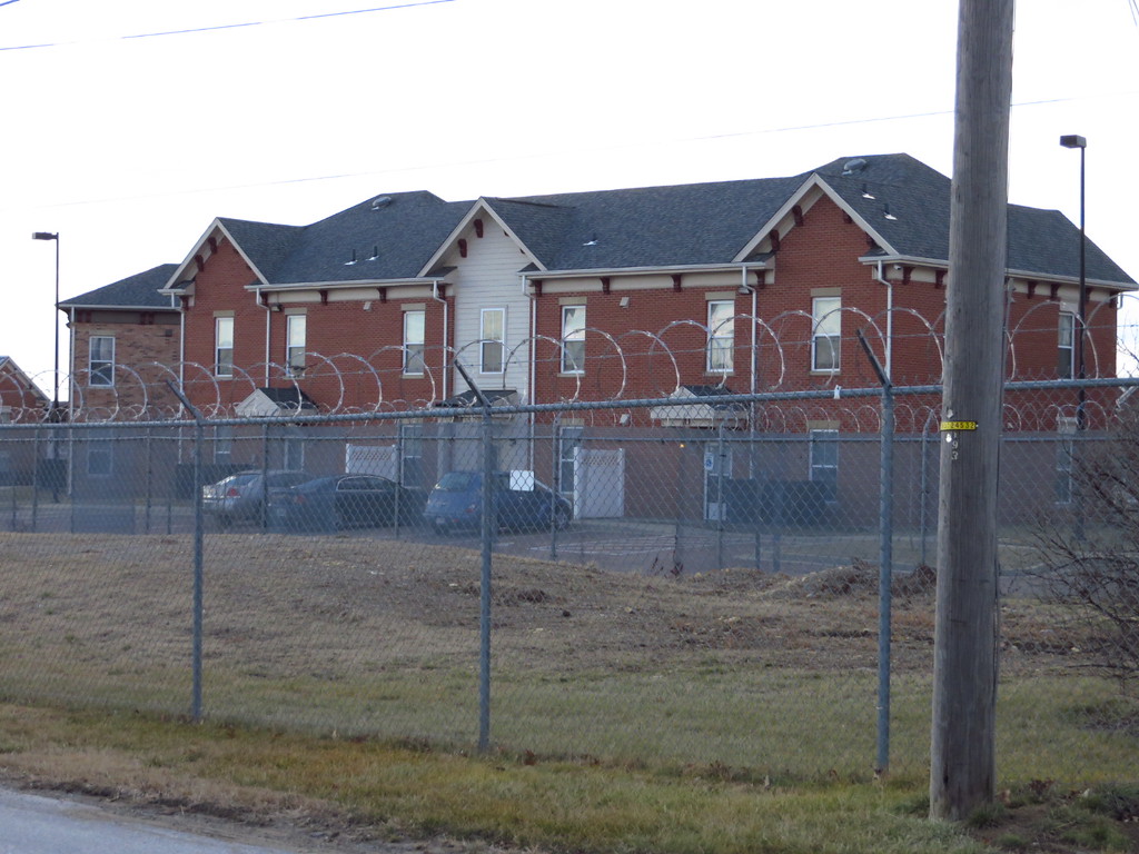
Apartments located across an industrial property protected by razor wire.
But what lies down Zesta is about what you’d expect in an industrial area. You’d probably feel more comfortable on this street in a forklift or a semi. In addition to the peanut butter plant there are a number of smaller operations and a sprawling industrial gas distributor.
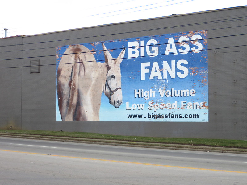
The former Big Ass Fans location on Winchester Road
Both Zesta and Magnolia feel more like a part of the adjacent industrial operations than public, city-maintained streets (which they are), and a significant stretch of Montgomery was lined with razor wire fence on one side and barbed wire on the other. I was actually a little surprised that I received as little attention as I did. By the time I reached Zesta, I’d actually convinced myself that these were private streets.
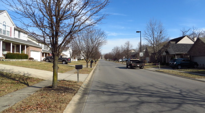
Today, I visited the Masterson Station neighborhood. The area I visited today dates from the mid- to late- 1990s, with houses a little larger than average. The area is fairly typical, in terms of architecture, topology, landscaping, of similarly aged neighborhoods. I liked Masterson Station Drive, which serves as a minor collector road. Unlike similar streets in similar neighborhoods, Masterson Station Drive is narrower and has a lower speed limit. It’s more pleasant to walk down and you don’t have to pity those residents of the street who have to pull out onto the road every morning during rush hour.
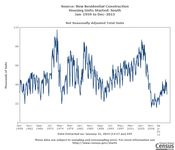
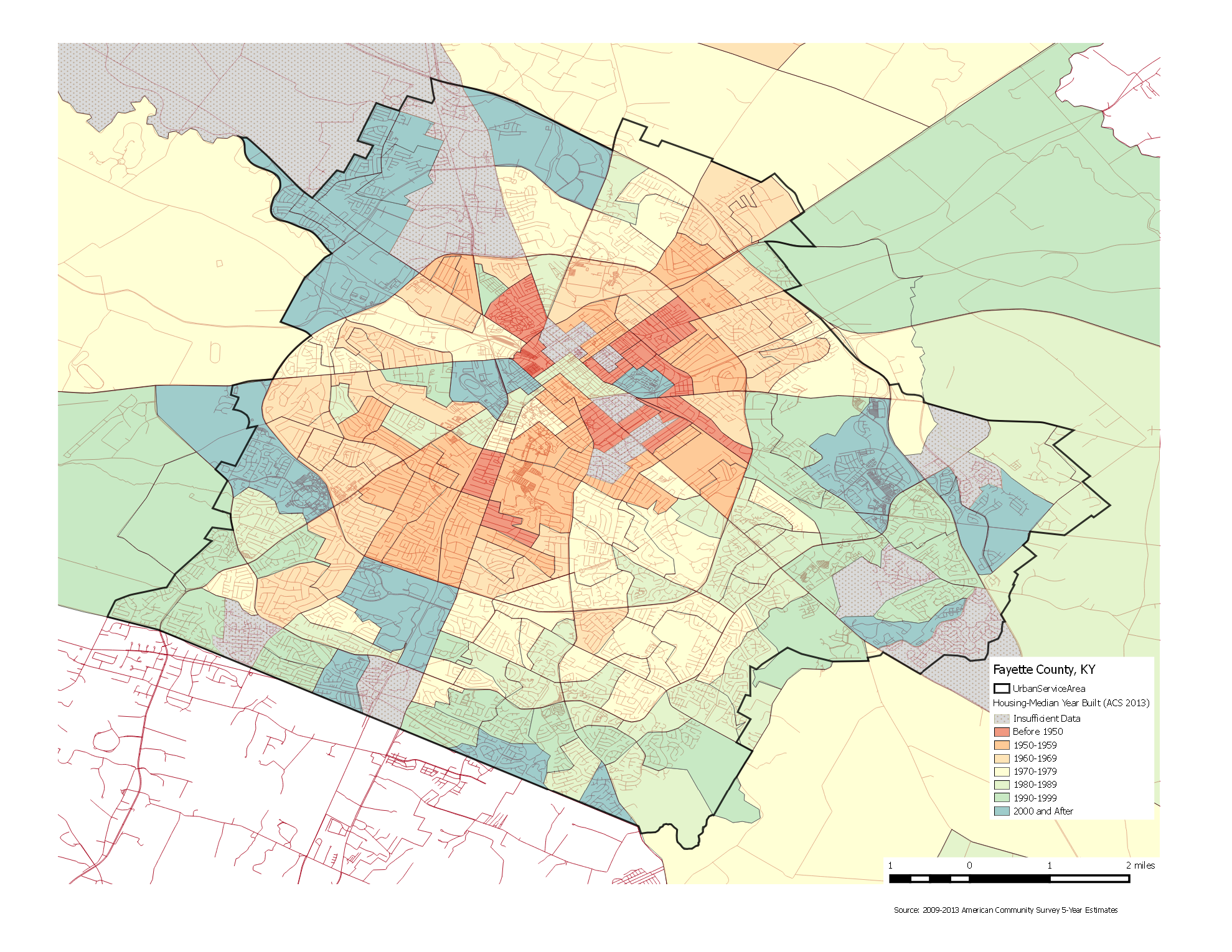
It seems like there is a surprisingly large number of houses from the 1990s and 2000s in Lexington. Growth, and especially exponential growth has the ability to do weird things. Lexington’s population grew from 225,000 people in 1990 to 308,000 people in 2013, a nearly 37% increase over that time. It wouldn’t be unreasonable to expect total housing units to increase by a similar amount over that period, which would mean that nearly a quarter of all housing units available in 2013 were built since 1990, even without some attrition of older housing.
In reality, the situation is a little more complicated, and housing starts are not solely driven by population. Census data for the South shows that housing starts increased fairly steadily over the 1990s and 2000s, peaking before the housing crisis and then declining rapidly. The data isn’t granular and can’t be explored at the level of metropolitan area but I imagine this story is familiar–boom and bust. The net impact though may be to confirm my impression that an awful lot of houses (perhaps too many!) were built during the 90s and 00s.
I wanted to visualize housing age in a different way, mapping neighborhood age. Census data on housing includes median year built at the census block level. (Census tracts are the base level at which the census reports population data; census blocks are subdivisions of tracts, though in many cases they are the same.) I sorted the data into bins by decade and then mapped them. There are problems with this representation. It doesn’t show margin of error which in some areas can be significant. It also doesn’t account for density, so while newer areas dominate in terms of area, it’s impossible to draw any conclusion about quantity of housing in any area. Still, it does provide some insights. New Circle Road appears to have been a fairly hard edge for development. Infill development like that in the East End (see Day 11) stands out.
Median Housing Age by Census Block (click to enlarge)
Two unusual buildings in the commercial area near Village and Versailles
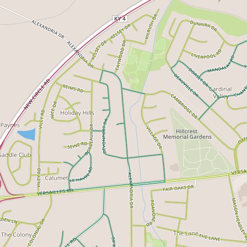
Today’s walk was in the Holiday Hills area, north of Versailles Road and Alexandria. This area has a mix of retail space along Alexandria and Village near Versailles, apartments, duplexes and single family homes. It appears to generally have been built out in the 1960s.
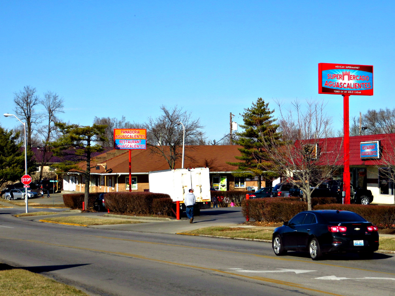
Supermarket on Alexandria
I was really impressed by how well this area seems to work. I passed retail, multi- and single-family housing, a park, bus stops, and even a library. All of these were being used. The sidewalks were not lacking for people I think about and talk about walkable access to things like parks, transit, and libraries, but sometimes imaging what it might feel like in practice in an average neighborhood is difficult; defining what how it should word, elusive. To see it at work in an established neighborhood was thrilling.
A few thoughts on what worked especially well and why: First, the retail was very focused on the needs of a Latino and Spanish-speaking customer base. Where most establishments of niche markets have to serve a geographically diverse customer base, these stores seem to have a pretty concentrated customer base. Second, the retail is ringed by high-density housing, with lower density housing beyond that. Plentiful nearby high-density housing seems to provide a critical mass of people who are willing to walk to nearby stores, parks, and transit, and this “activates” the sidewalk. Drivers are cognizant of pedestrians–they expect people to be crossing streets on foot. So, enough people are walking that walking is actually safer. Walking seems so natural here. I caught someone leaving there house to walk to some destination as casually as I might walk to another room. Infrastructure, attitudes, customer base and destinations reinforce each other to make the whole thing work efficiently.
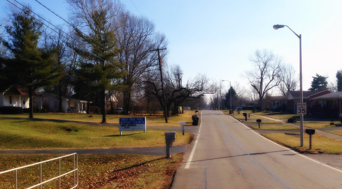
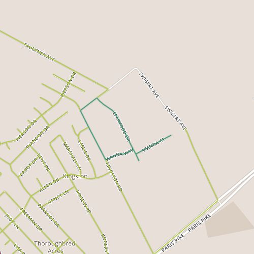
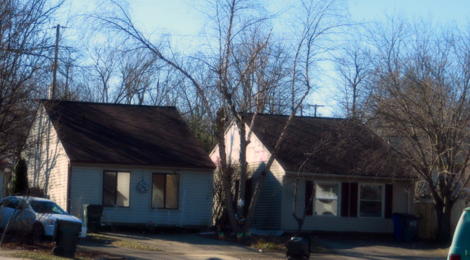
Today’s walk was near the northeastern edge of the urban service area. The edge of the urban service area is very pronounced on the south side of Lexington where it corresponds with the Fayette/Jessamine county line. On one side, there are densely packed suburban houses. On the other, there is farmland. The line is less defined on the north side, where the city blends gradually into country. Today’s walk was in one of these edge neighborhoods, near the Joyland neighborhood but distinct from it. The area includes several small subdivisions, including the Mar-Lou subdivision along Wanda with 60s-vintage brick ranch houses, the Elmwood Heights subdivision along Elmwood with smaller, older frame houses, and some unaffiliated houses on deep lots, some nearly a full acre, along the north side of Kingston.
Although each of these stretches are distinct, they all give the sense of being rural rather than urban. Horses graze on the properties behind houses on Wanda. Elmwood feels the most suburban, but derives a small-town feel nonetheless, possibly from variety in form (presence of sidewalks or fences, or to a lesser extent, style of housing). In any case, Elmwood feels nothing like the newer suburbs on the south side. The setbacks on Kingston are deep–well beyond that of a typical suburb. The takeaway here may be the different ways in which a particular neighborhood feel is accomplished: reference to surroundings, for example the contrast of suburban houses with agricultural land or even contrast between neighbors, is powerful here.
Today, I returned to the Century Hills neighborhood, which I’ve already seen a couple of times, on Days 6 and 58. (Such is my luck with random path selection). This section did offer a couple of things I hadn’t seen before.
There is a different and more limited selection of house models, most of which have side gables and side entrances. There aren’t a lot of garages, so houses have driveways that lead up to the front windows. The lack of front doors coupled with long blank roofs facing the street is unique experience visually.
I also had passed the neighborhood shopping center which was bustling. There is a recently constructed outbuilding in the shopping center. Though it’s vacant, when I passed there were people in the building. Perhaps it won’t be vacant long. This portion of Buckhorn feels like a hub, with lots of activity including several people on foot despite temperatures in the mid 20s. Buckhorn is also served by a bus line and the Squires Road Trail. It passes by Berry Hill Park; though I didn’t walk past the park today, I could see construction just underway for a new skate park there.
The combination of public space (specifically the park) and retail seems to work together to generate investment and pedestrian trips that one imagines should strengthen the neighborhood. But while it’s evident here, it’s impact seems to be fairly limited–in fact, I’ve already noted how the sidewalks seem to be taken for granted in one of the nearby portions of the neighborhood. In light of my recent readings on the impacts of street grids, I’m inclined to think street layout has something to do with this.
 I know you’ve always wanted to know what, exactly, is down Zesta Place. Today’s walk was an exploration of the industrial area surrounding the Jif peanut butter plant on Winchester Road including the intriguingly-named Zesta. (Did someone intentionally name a street that runs by a peanut butter plant after a cracker?)