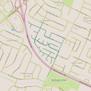
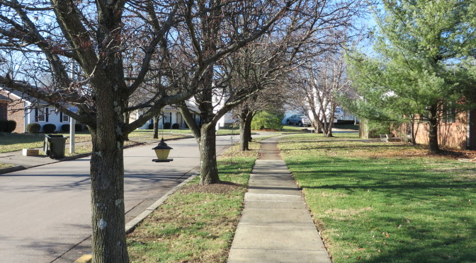
 Today, I toured the Pera Place neighborhood. This area seems to be two fairly distinct areas. The northern area was built out in the 1980’s, the southern area in the mid 1990’s. The northern area is interesting in that the architectural style is visually right in between the ranch styles popular in Lexington neighborhoods built in the 1960’s and 70’s and the styles that are present in neighborhoods built since the 1990’s. In addition to the being newer, the houses in the southern area are smaller and a little less illustrative of the progression of housing styles. The two sections also have different themes for the street names–Southeast European place names in the north and botanical names in the south. With the addition of some bogeys, there are some interesting intersections–I imagine directing someone to a house near the intersection of Waco and Dardanelles!
Entry signs at the entry to this neighborhood clearly indicate that this is the Pera Place subdivision, but nearby a street signs carry the Pasadena neighborhood badge. So, the question is, what makes a neighborhood? As a starting point, I’d like some well-defined neighborhood boundaries. My home city of Denver has neighborhoods nailed down pretty well, with the neighborhoods there being clearly defined. Individuals may understand different boundaries or a different name for a given neighborhood, but a consistent designation exists. Departments within the city and people who live there can speak the same language.

This doesn’t seem to be the case in Lexington. The Property Value Assessor’s office seems to have a comprehensive list, but the PVA-Neighborhood field is (based on my experience) probably not well-aligned with names and boundaries that Lexingtonians would recognize and may have too fine a granularity to be useful for demographic purposes. LexingtonKY.gov has a list of neighborhood associations, but once again, this is an imperfect list with lots of room for overlap and granularity issues. There are entries for specific addresses; Chenault Road and Chevy Chase both have entries even though Chevy Chase includes Chenault Road. Wikipedia has an opinion, too, with a list of neighborhoods and links to an external site. But it may well be incomplete; it doesn’t include an entry for Pera Place (and in case you’re wondering, it’s entry for Pasadena makes clear it applies only to the adjacent neighborhood and doesn’t include Pera Place. None of these are really satisfying. I hope I’ve overlooked a good source and someone can point me in the right direction. Otherwise, this would be a nice gap to fill.
This still doesn’t answer the question about what makes up a neighborhood, something I reflected on while walking though these two distinct areas. I foresee other opportunities to yank on this thread in the future, so I’ll leave it for now!
