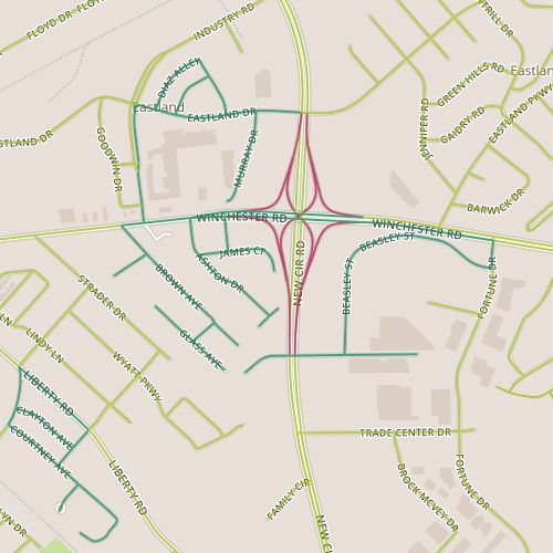
Today’s walk required a short walk across New Circle Road on Winchester and the area immediately southwest of the interchange, which is one of the busiest interchanges in Lexington. The areas adjacent to the interchange are commercial and include a couple of self-storage facilities on James and a newer office building. Ashton and Forston make up a hidden residential neighborhood, very similar to the neighboring area I passed through on Day 23. The homes here are modest, generally 1940’s vintage though with some newer houses mixed in and some addition room for further infill. This is another neighborhood that isn’t self-conscious, and though this can sometimes result in some rough edges, this area exuded a sense of pride. There is probably a long list of housing qualities, objective and subjective, that you could measure–size and age to name a few. This area outperforms expectations for upkeep based on size, age, construction.
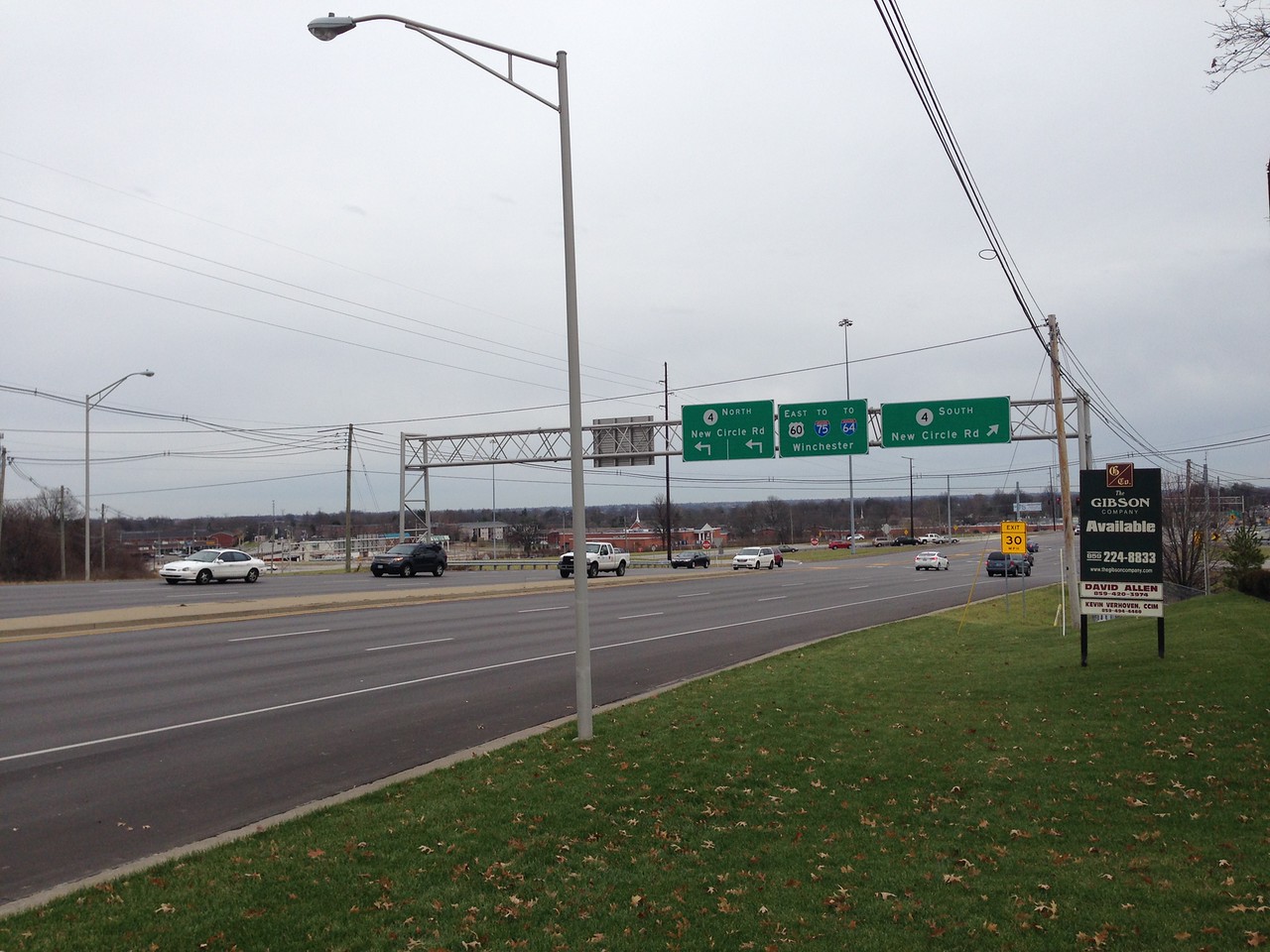
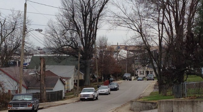
Looking east along Winchester toward New Circle Road interchange
Winchester and New Circle Road really isolate this area perceptually; from a car, it’s easy to pass without thinking of the side streets; on foot, crossing either Winchester or New Circle is an adventure. With the retail businesses on the north side of Winchester, it would be nice to see this stretch get some pedestrian improvements.
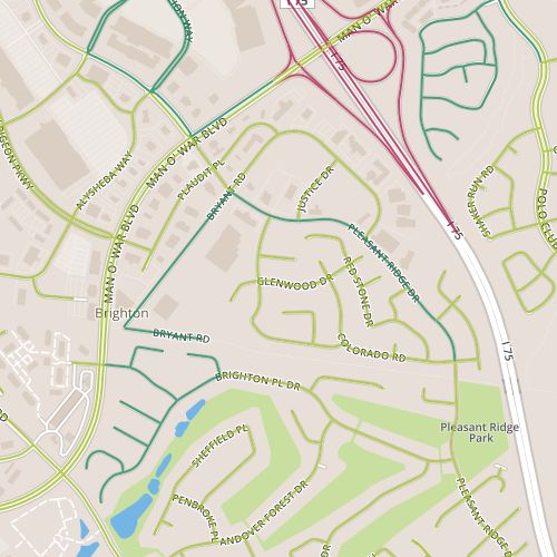
Today’s walk encompassed some of the larger commercial properties on the south side of the Hamburg area, along Bryant and Pleasant Ridge, as well as a portion of the Timber Creek neighborhood near Pleasant Ridge park, as well as a portion of the Brighton East “rail trail” connecting those two pieces.
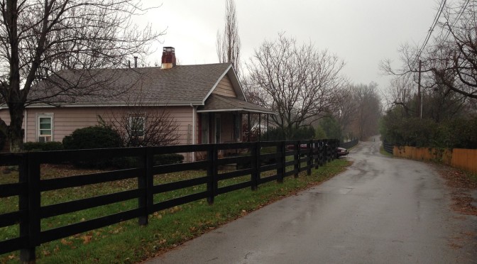
The portion along Bryant is generally warehouse-sized commercial–large gyms, a furniture outlet. There are also a few odd homes in here, holdouts, perhaps. Some of these lots front the newer mixed-used trail; a sign at the entrance to the trail (the “elbow” of Bryant) states “authorized vehicles only” are allowed to pass. Apparently homeowners are authorized! The trail itself is part of the first “Rails to Trails” project in Lexington, completed in 2006. These projects seek to convert existing railroad right-of-ways to mixed-used trails. Currently there are a lot of short segments like this, but a little investigation shows that there are plans in place to extend and connect the trails.
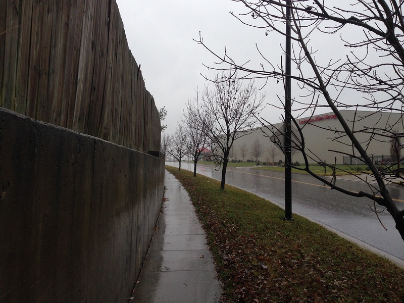
Concrete Retaining Wall along Pleasant Ridge
I was excited about this walk, mainly for the chance to incorporate a trail–perhaps a little too eager to take it on. I thought I’d caught a break in the rainy weather and would have a chance to walk in relatively light rain; instead, I spent most of the walk in steady downpour. One of the neat things about this process is that I’m rediscovering walking the joys of walking in all sorts of weather, but this really depends on being dressed appropriately, and today I was not. This will serve as a reminder to bring a raincoat. At any rate, by the time I reached the residential segment of the walk, I was less focused on observation and more focused on moving quickly. This stretch consists mainly of the back of houses, blank space that often occurs in suburban neighborhoods along feeder routes like Pleasant Ridge that serve to channel traffic out of neighborhoods to larger streets. This kind of space is usually neglected, but here the area was clean and well maintained. I think some decoration along a short concrete retaining wall could add something.
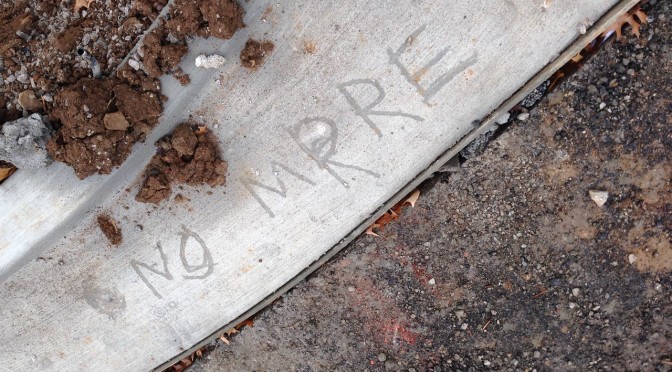
It’s hard to fix mistakes written in concrete. I came across the words “No More” scrawled in relatively fresh concrete in the drive way of some new structures along Mitchell and behind Harrodsburg near Lane Allen, a 1950’s era commercial district undergoing significant change. One wonders…no more what? Is this a response to the buildings, the construction itself–no more McDonald’s? Or to something else, a protest against police brutality or a complaint about algebra homework? The mystery is tantalizing, and should grow as it gets older.
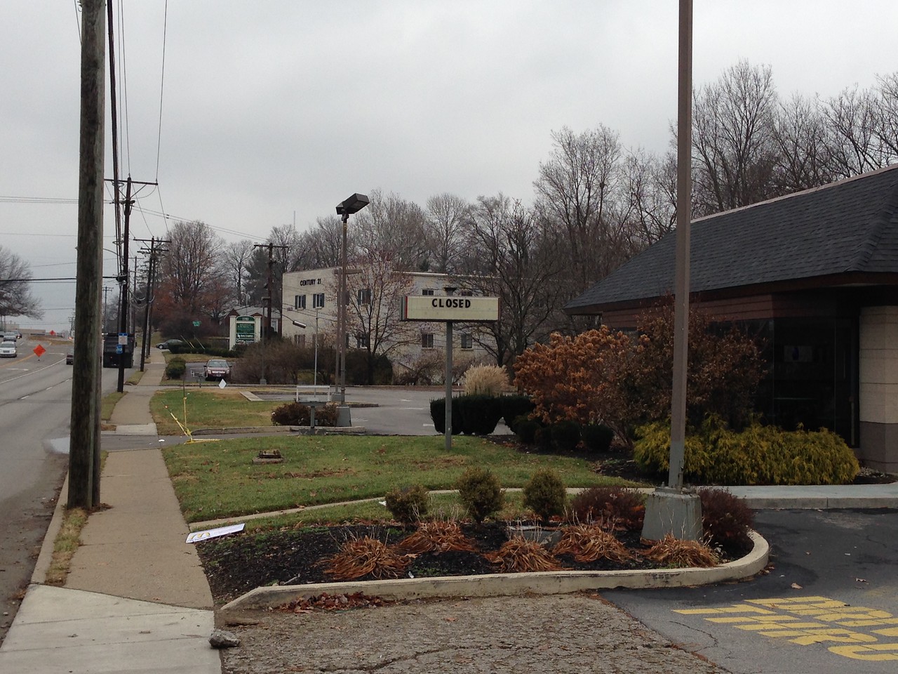
The old McDonald’s is closed.
Jack White of the Raconteurs sings “You wrote our names down on the sidewalk/then the rain came and washed ’em off/So we should write ’em again on wet cement/so maybe people a long time from now will know what we meant.” And while he wasn’t talking about streets and buildings, it’s interesting to try to put that meaning to it. The messages we put in concrete today, in the form of roads and buildings, will be with us for generations. Walking through this 1950’s neighborhood, it’s tough not to think about how society’s preferences–choices made 60 years ago–are reflected in the streetscape, and wonder what the new structures say about us.
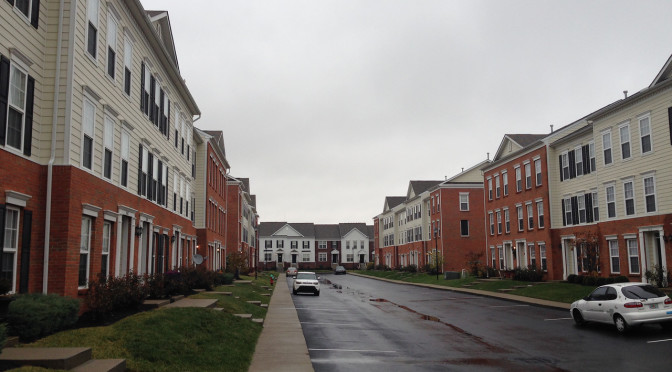
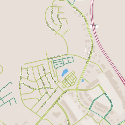
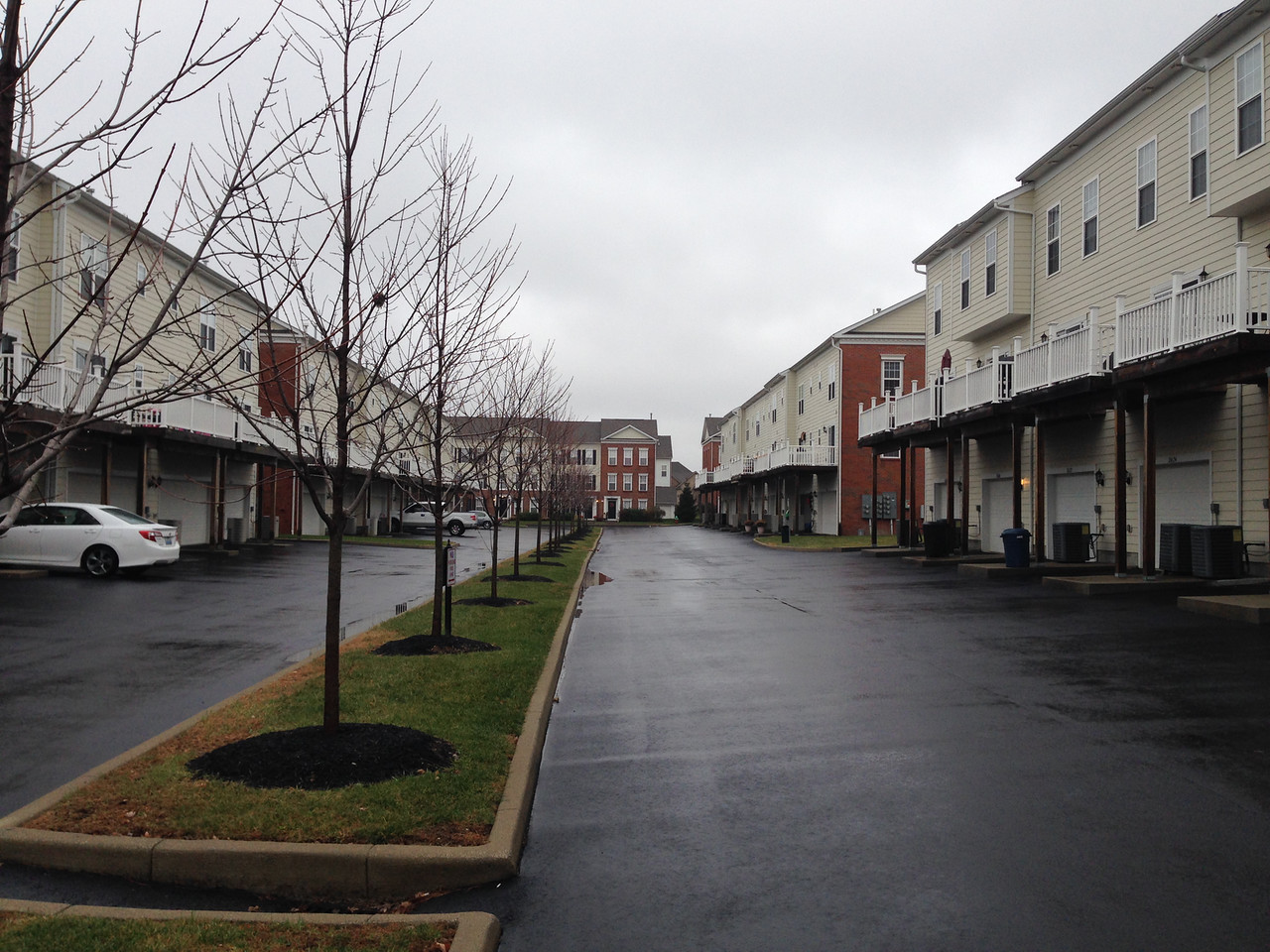
Today, I went by townhouse-style condominiums in the Hamburg Farms area. These are a relatively recent addition to the landscape; it looks like construction in this area completed in 2008. There isn’t a lot to say about this area; this entire trip was contained withing the complex. I’ve mentioned the parking woes of dense suburban housing before. The issue here is solved by paving space that in other complexes would have been (for better or worse) greenspace; at the time I walked through there were plenty of available parking spaces but very little green.
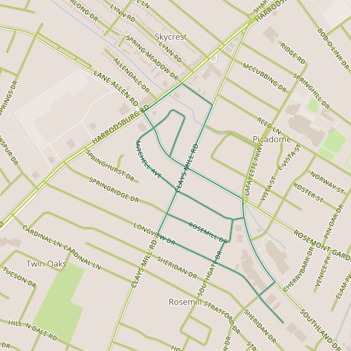
This is a good time to work in a note about the dataset. I’m using street data from the Lexington GIS Open Data “portal” to define streets (and I’ve mentioned before, ideally I’d like to add in trails as well). In some cases, driveways in apartment complexes or shopping centers that are clearly private are in the data set (and maintenance responsibility is identified as private). In other cases, these driveways are not included. The end result is that not everything that looks like a street is a street, and some things that don’t look like streets are. The latter is the case in Hamburg Farms; these alleys look nothing like streets. Though they are named, it’s clear they belong to the complex.
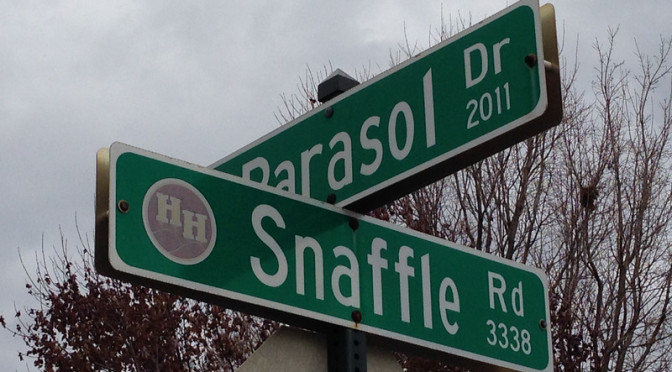
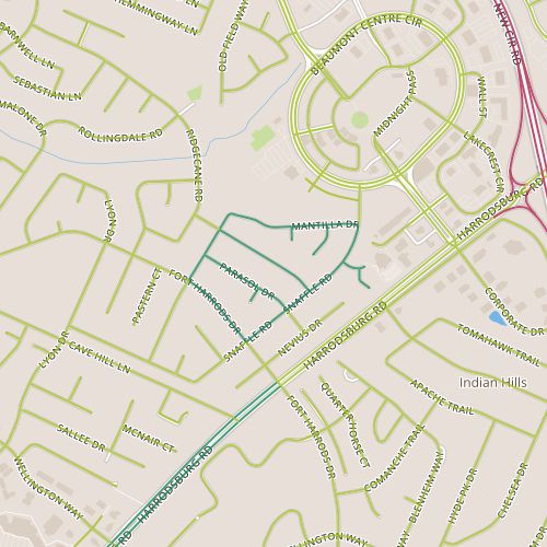
Today’s walk was my first journey to the 40513 zip code, to a neighborhood know as Harrod’s Hill, just west of Harrodsburg and to the south of Beaumont Centre and New Circle Road. Houses here appear large…super-sized versions of the ranch-style houses from many of the 1970’s and 80’s neighborhoods I’ve passed through. Not surprisingly, the older portions (on the Ft. Harrods side) are from the early 1980’s, perhaps representing an early spike in increasing home sizes? The street names in this area were fascinating, too, with esoteric object names from Snaffle and Mantilla to foreign names like Bamboo and Mesa, common names like Mallory and historic names like Webster (behind the Beaumont branch of the Lexington Public Library and next to Literary.)
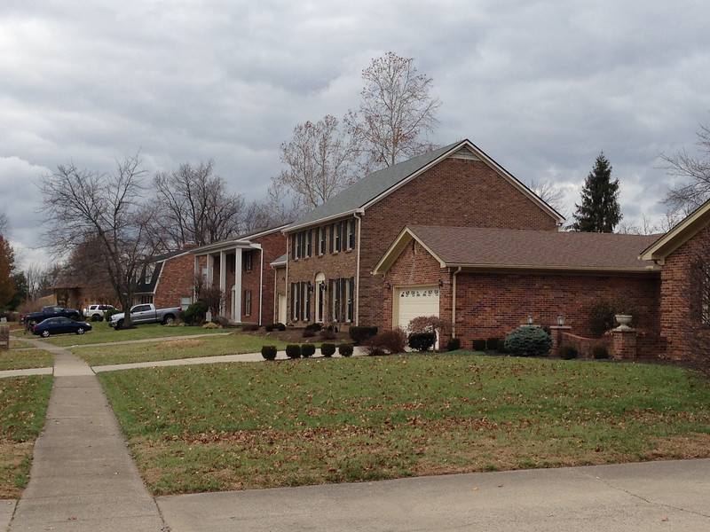
A selection of the architecture style in use in the Harrod’s Hill neighborhood
This area repeats a theme that I’ve seen occasionally in other Lexington neighborhoods, a series of long parallel streets, usually a set of three or four, connected at the end but without repeated connections to an arterial street. In a way, areas like this feel more like neighborhoods to me. (I grew up in areas with a very regular street grid, and I don’t doubt this factors into how I feel.) There are benefits to well-connected streets–that is, ones that allow many possible paths between two points. I enjoyed being able to choose between multiple routes in order to vary the scenery, but alternate routes are also helpful if you’re avoiding, say, a mad dog in a front yard or a bully. Street network analysis is fascinating, and hopefully I can work in some of the interesting thoughts I’ve come across on this in the future.
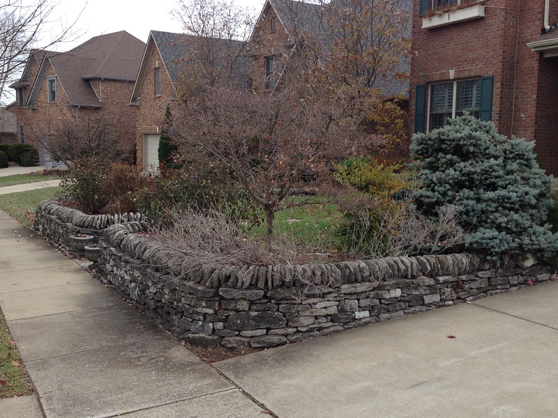
A limestone fence surrounds a yard in the Harrod’s Hill area
I noticed something unusual in this area–it seemed much more willing to express religious views than I’ve seen in other areas. This was evident not just in holiday light displays (which are just beginning to appear) but in other ways–with license plates, or a biblical passage engraved on a mailbox. This is somewhat unusual for upper middle class neighborhoods which as I’ve mentioned before seem to be somewhat reserved in terms of how residents present themselves to the outside world. I’ve heard people express concern recently about what they perceive as our growing tendency to “self-sort,” to choose neighbors whose views mirror our own. And sure, plentiful outward signs like these could lead some house-hunters to avoid this area or others to favor it, perhaps leading to some self-sorting. But I really appreciated the willingness of residents here to express themselves, and I have to thing that our collective views are so fluid (even a group of people with the same views could have significantly wider range of views after a generation) that self-sorting itself, at least at the neighborhood level, is probably an insignificant issue.
 Today’s walk required a short walk across New Circle Road on Winchester and the area immediately southwest of the interchange, which is one of the busiest interchanges in Lexington. The areas adjacent to the interchange are commercial and include a couple of self-storage facilities on James and a newer office building. Ashton and Forston make up a hidden residential neighborhood, very similar to the neighboring area I passed through on Day 23. The homes here are modest, generally 1940’s vintage though with some newer houses mixed in and some addition room for further infill. This is another neighborhood that isn’t self-conscious, and though this can sometimes result in some rough edges, this area exuded a sense of pride. There is probably a long list of housing qualities, objective and subjective, that you could measure–size and age to name a few. This area outperforms expectations for upkeep based on size, age, construction.