Category Archives: Uncategorized

Day 59-Clusters, not blocks

day 59 
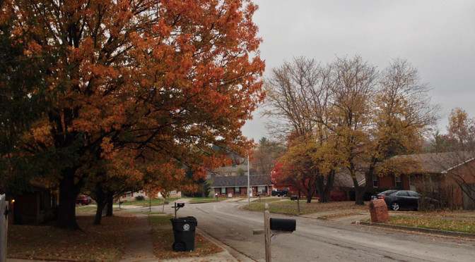
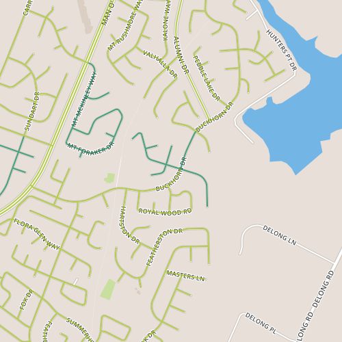
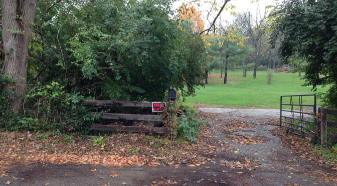
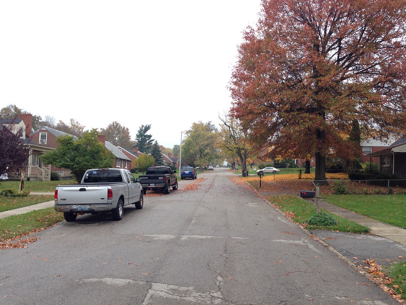
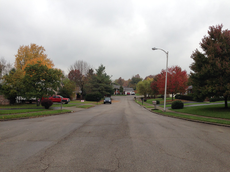
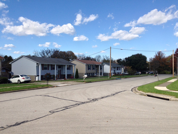
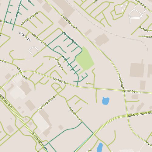
Today took me to an area near Woodhill park, not far from the area I visited on Day 3.   On that day, I actually walked through two distinct areas, the southernmost of which was the same neighborhood, Shadow Wood, that made up all of today’s walk. This area was built in the 80’s and a common design is a shed roof or a similar offset roof that is unique.  Many of these homes still have wooden batten siding that I assume was originally present throughout.  Most houses have been upgraded to vinyl siding.  Another feature of this neighborhood is that the layout results in clusters of houses more than blocks of houses (especially on the west side of Woodhill), where clusters along a street are essentially connected at the back.  This is similar to the neighborhood from Day 19.   Most houses feel like they have multiple “next door” neighbors.  This may or may not have resulted in an increased sense of community, but it seems like a neat experiment.

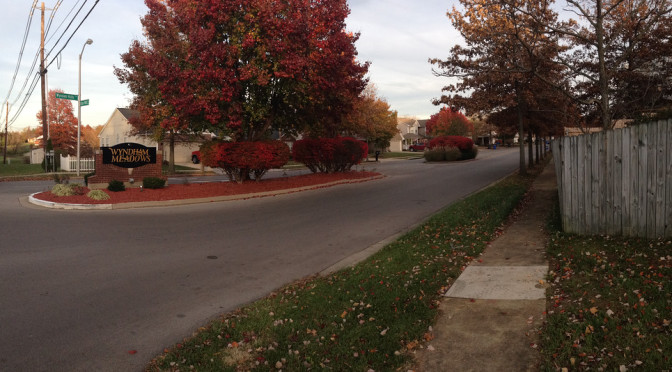
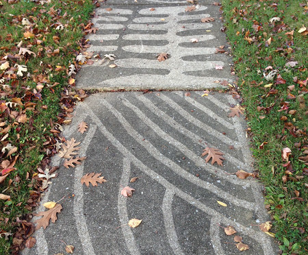
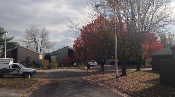
One of the neat things about this project will be seeing the same neighborhood at different times of year to see how it changes.  Generally, yards are a neat communication tool, a projection of the occupants.  Sometimes blending in or simply being unintrusive offers as much information as standing out.  Gardens and lawns have already taken a back seat to seasonal decorations (and it’ll be interesting to see how different residential areas address the dismal depths of winter, after Christmas decorations come down).   A few homes here offered some hints on how this might be done with colorful, non-holiday-specific flags and similar yard decorations.  Mostly, though, yards here tend toward the inconspicuous.  So, this neighborhood (at least as seen in November) seems to be cozy and introverted.

Day 58-Sidewalk as recreational amenity

day 58Today’s walk was a chilly one, with flurries flying as I passed through the Century Hills area around Buckhorn road.  The houses here are 1980’s vintage following a ranch-style layout.  And though this is clearly tract housing with a limited number of models and the houses themselves are relatively austere, I think the architecture is above par.  Some models have clerestory windows, others have a unique bay window design.

There weren’t a lot of surprises here.  A sign near a stream calls attention to a sewer line replacement project that turns out to be one of many projects intended to eliminate sanitary sewer overflows and make other improvements to meet Clean Water Act requirements.  There were some other hints about interesting negative space including a cell tower that is in the middle of the dogleg at the north end of Smoky Mountain.  Otherwise, this felt like a pretty typical residential area.

A couple of things struck me today.  The first is the consistency in street form between post-war middle class neighborhoods, (particularly where single-family homes dominate).  These neighborhoods reliably have sidewalks with reasonably sized treelawns whether they were built out in the 1950’s or 2010’s.  I compare this to my experience in other places where sidewalks (if they exist at all) may or may not be located directly alongside the street.  It’s consistent enough to make one almost believe it’s been codified.  But not quite, because some neighborhoods, usually at the higher end of the price range, do forgo sidewalks.

The second is how differently sidewalks are treated in different places.  You’re more likely to find cars parked over sidewalks on cul-de-sacs (here, a car is parked on and along the sidewalk, apparently this is ok with the neighbors).  In places, streets are acceptable places for overflow parking while in others, driveways are packed (often at the expense of streets) to keep streets open.  Sidewalks usually feel as if they are treated as an amenity within neighborhoods, something to be used to walk the dog or to go for a stroll.   But its an amenity whose value differs depending on where you go.

Day 57-Small town feel at the edge of the city

day 57Today took me to the Copper Trace neighborhood (really, a collection of several subdivisions including Wyndham Ridge), along the Fayette/Jessamine border near the point where Clay’s Mill Road crosses it.  The homes in this area seem a little older than they actually are–I would have guessed the oldest houses here were from the 1980’s, but they seem to generally have been built in the 1990’s and early 2000’s.  Overall, the neighborhood has a pleasant aesthetic, with tree-lined  streets and lot sizes that aren’t really “cozy” but which aren’t wide open either.  I’m all about subjective impressions, and this area (especially the portions along Weber) didn’t feel so much like a neighborhood in a city the size of Lexington as a neighborhood in a much smaller town.

Beyond the small-town feel provided by the streetscape,  the most notable aspects of this area are related to it’s proximity (like the walk on Day 50) to the county border.  Some houses on Weber back to the county border which is pretty clearly delineated here with houses on one side and agricultural land on the other.  Besides the striking visuals of tract homes next to open space, this also provides some auditory sense of distance with the noise from some far away arterial that probably would be dampened in a neighborhood further from the edge of the city.  This portion of Clay’s Mill is probably one of the loneliest stretches of sidewalk I’ve encountered, with a long stretch behind the backs of houses and especially with traffic pouring out of the city at the end of the day.

Day 56-Youth and Wisdom

day 56Today I took another trip out along Bryan Station and walked through several smaller subdivisions.  The big surprise here was the variety of housing ages (and sizes) that I encountered over a fairly short stretch with houses from the 1950’s and 60’s next to a subdivision with lots that have not yet been built.

There is a lesson here about growth patterns and maybe about entropy.  This newest subdivision appears to have been cut off a neighboring parcel belonging to a church.  In a lot of ways, this reminded me of the Pinehurst area from Day 16, and oddly enough, this neighborhood is listed under the same “neighborhood” name by the assessor’s office.  The other Pinehurst is close but it’s not obviously connected and my belief at the time I walked it was that it was cut off a privately-owned property (so perhaps using the same name is a simple convention for the assessor?)  But there are similarities, in that both appear to have been divided off larger properties, not exactly as infill but almost having the affect of a small infill project.  Anyway, I think this area’s strength is in the range of housing ages, something made possible by this subdivision of larger parcels.

Subdivision of property is interesting though.  It’s never as easy to assemble pieces back together as it is to subdivide.  It usually takes concerted effort.  It reminds me of watching oil in a pot of boiling water while it separates and then recombines.  And so, I would say that watching the development patterns of Lexington  is sort of like watching that oil.  (This is true of any city, really, but particularly Lexington because of the value of the agricultural lands surrounding it.)  Larger parcels get broken down and sometimes these are broken immediately into small pieces like house lots.  Other times they are medium-size parcels, an agricultural reserve, a church, maybe a house with acreage.  These midsized lots can be broken down further and often, eventually, they are.  And this is sort of fascinating.  Looking at the map of this area, there are places where this sort of thing could easily happen again.

Among all of this, I found among a couple of my snapshots a couple of photos of similar scenes in different subdivisions.  I think seeing these two photos side by side is a nice way to show the impact of setbacks on the “feel” of a street.

View of a street in Northwood constructed in the 1950's
View of a street in Northwood constructed in the 1950’s

The first photo is from the Northwood neighborhood.  Here the houses are mostly 1 or 1-1/2 floors.  Houses are set relatively close to the sidewalk.  The street feels cozy.

View of a street in Kenawood constructed in the 1960's.
View of a street in Kenawood constructed in the 1960’s.


The second photo is from the Kenawood neighborhood, just across Bryan Station.  This area was built only a little later, in the early 1960’s.  Houses are ranch style houses, so they are probably  close in size, but they are set back further from the street.  This street feels more open.  The difference is subtle and other elements, like street-parked cars and trees, have an impact as well.

A final though.  I took advantage of this walk today to walk through the area I first wrote about on Day 5.  One of the questions I had at that time was whether my expectations about political leanings would be borne out by the yard signs that would inevitably appear.  As it turns out, sort of.  That neighborhood seems to be pretty evenly mixed, befitting of the mixed signals I was getting then!

Day 55-Negative Space

Day 55 Today’s walk took me to a residential area just north of Man O’War near Armstrong Mill Road.  The homes here were a little deceptive, in that I noticed that several houses didn’t have garages facing the street, so I overestimated their age.  The houses here turn out to be “2-story” ranch type houses from the 1970’s and early 80’s.

Homes without obvious garages

There weren’t a lot of surprises here.  This neighborhood seemed to be about in the center of all the informal metrics I’ve been tracking: playfulness of Halloween decorations, political leanings based on yard signs, number of people walking/running/biking.  I think my favorite thing may have been a stretch of sidewalk that had been power-washed to draw sometimes intricate patters on the sidewalk.  I was also intrigued by the topography; houses in the back of the neighborhood had utility poles in the backyard that were low enough to indicate a fairly steep, deep depression.  I think it would be fascinating to see, for lack of a better term, a “negative space” map of the city, showing these backyards that back up to each other and the way utility lines run through the city.