Category Archives: Uncategorized

Day 49-Going by slow

day 49
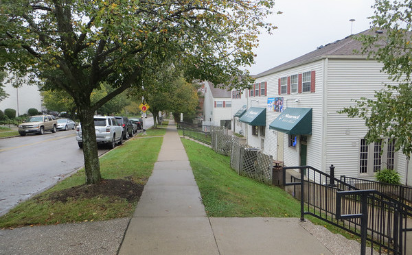
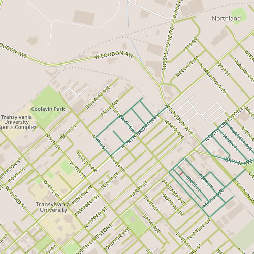
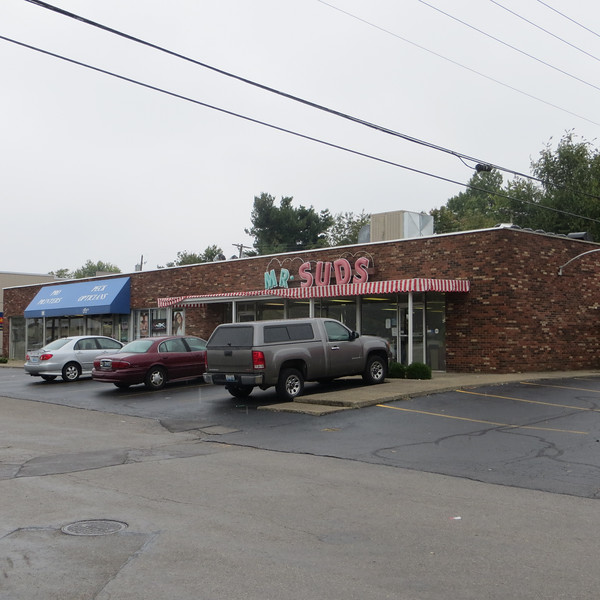
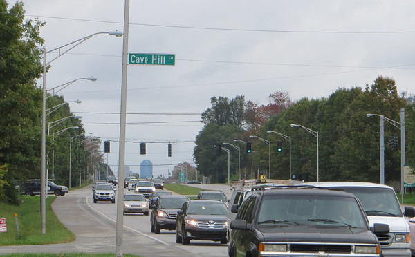
A song from a band called Poi Dog Pondering captured my attention a long time ago with a song about walking even when other alternatives were available.  The song’s conclusion, that “you get to know things better/when they go by slow,” has been among the motivators for this project.  Today’s walk was along a stretch of one of Lexington’s spoke arterials, Harrodsburg Road, which takes traffic from downtown to Jessamine county, Nicholasville and points beyond.  This particular stretch is not slow; there aren’t many reasons to slow down.  There are a few feeder routes into neighborhoods and a shopping district at the corner of Man O’ War and Harrodsburg, but none of these have ever drawn significant enough traffic to slow down this drive.

Signage for Palomar Centre at Man O'War and Harrodsburg
Signage for Palomar Centre at Man O’War and Harrodsburg

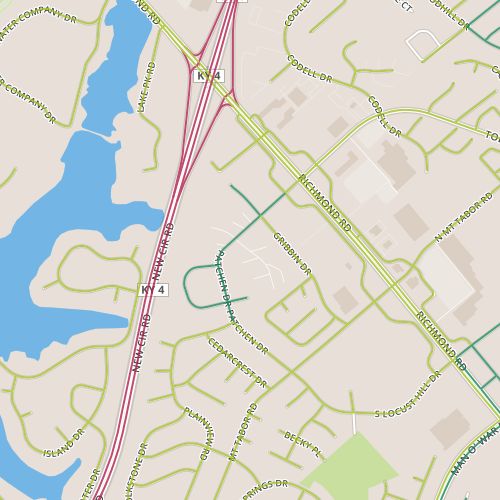
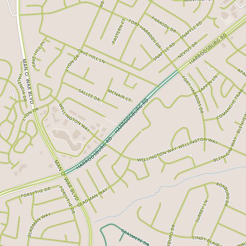
It’s not, at the first glance, a terribly exciting route, but it’s the first in what I expect will be a series of trips down arterials that are necessitated by low density of connected feeder routes along them.  That is, in many cases it is difficult to find an efficient loop that would be short enough for me to walk.  Compare this to my routes along Winchester Road, a similar spoke arterial, but one that intersects smaller streets much more frequently.  At any rate, planning this route was a little like making sure there was some broccoli on the menu.

Hidden mansion along Harrodsburg

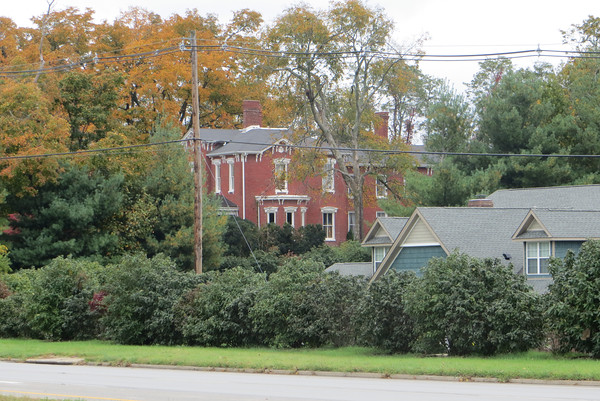
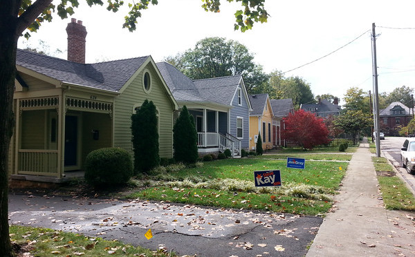
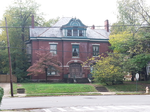
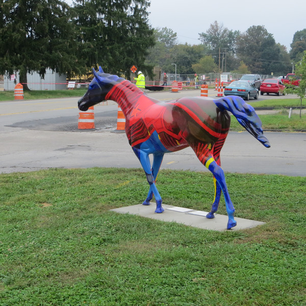
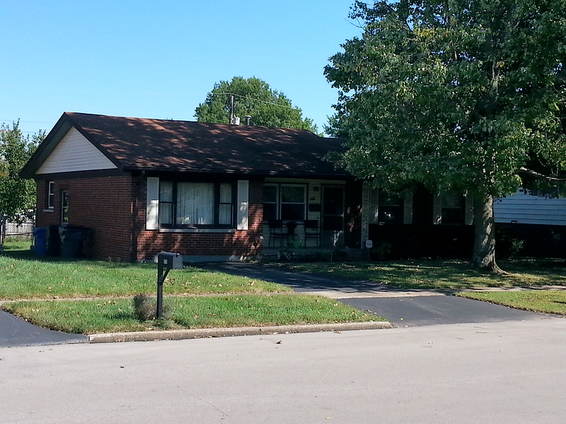
The potential payoff was really from watching it go by at three miles per hour instead of 55.  And  I did see a few things I wouldn’t have otherwise, including, hidden among the trees, a large mansion built in 1851.  The wooded areas on either side provide might provide some adventure for the right people, ambitious kids or geocachers, maybe and there were a couple of other unusual properties as well.  Would I walk this stretch of Harrodsburg again?  Probably not, but sometimes you do things just so you can say you did it.

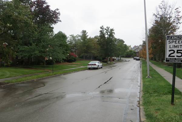
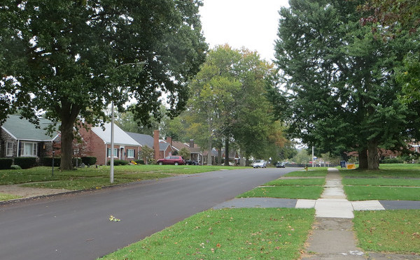
What works: This stretch of road is good at what it does.

What doesn’t (for my purposes, anyway): What it does has nothing to do with people travelling on foot.

Day 48-Townhomes…and Townshops

day 48I ran into a little bit of fall rain during today’s walk in the Patchen Woods subdivision just southeast of Richmond Road and just outside of New Circle Road.  Overall, it was a nice enough day for walking, with the rain and gray sky bringing out some of the fall color.  I passed through several different areas here, with single family homes, attached homes, apartments and commercial space sharing a relatively short stretch of Patchen Drive.

Fall color on Chippendale Circle

Perhaps my favorite surprise was finding a real alley in this relatively new (1980’s era) neighborhood, an alley that allows not only trash collection but also car storage to be hidden by the houses on either side.  The entire residential area along Chippendale is pleasant.  The mature trees and tall brick facades of the houses give this block a rich feel, but even the portions alongside apartment buildings feel welcoming in a way that apartment complexes usually don’t.  There are other apartments along this stretch of Patchen that are more forgettable, but the scale never feels overwhelming, possibly because none of these complexes have parking lots along the street.

The commercial areas don’t follow this a strictly (parts of Gribbin are faced with parking lots) but the shopping complexes here are probably somewhat unique in their design.  Parking is located along two sides of the complex and on-street parking is available on a third side.  But many of the businesses don’t face the parking lots and some are located on the inside of the complex.  So on a day like today, customers have to walk in the rain for a short distance.  (And of course, they would anyway!)  It was refreshing to see commercial property that allows people to realize they won’t melt if they don’t go directly from paved parking lot to conditioned space.  A second interesting aspect of this area is that the complex buildings look a lot like apartment buildings.  I wonder if they were planned as apartments originally and converted to  commercial space to meet changing demand, though they’re not the only commercial spaces with a strong residential appearance in Lexington.

What works: Human scale helps create a strong connection through the neighborhood to commercial districts along Patchen and Richmond.

What doesn’t: Richmond is so car-oriented, it doesn’t really matter.

Day 47-Divided on the Mayor

day 47Today took me to the neighborhood near West Sixth and Broadway.  This stretch of Broadway is a commercial corridor, and the neighborhood sits behind it.  It’s an older neighborhood, one of the oldest I’ve seen so far, with many houses dating to the first decade of the 20th century.  There were also some gaps, vacant properties that probably won’t stay undeveloped for long.

As this is the season of yard signs, one thing stood out to me.  This area appears to be split geographically in terms of energized support for the two mayoral candidates, with the older portions to the south and west favoring the incumbent Jim Gray and the (slightly) newer portions supporting the challenger Anthany Beatty.  One could come up with plenty of reasons for this, and it could be a fluke.  I do think Beatty’s campaign slogan is worth some thought.  He claims he will be  “Mayor of ALL of Lexington,” leveling criticism at Gray that he is too focused on the downtown areas at the expense of the suburban and rural parts of the city.  I think it’s a good slogan, getting right to the heart of the problem that planning-oriented or big-project mayors have.  Attention on big projects or urban centers can appear to neglect major portions of the city, and even stakeholders in areas of focus if development may change neighborhood character.

Early 1900's house on West Sixth St.
Early 1900’s house on West Sixth St.

Appearing to neglect and actually neglecting are different things and campaigns rarely have time for nuance.  But Beatty’s signs are pretty widespread throughout Lexington and it’s easy to believe the residents of this area have a good reason to support him.


What works:  This appears to be a cared-for area with character.

What doesn’t: It may be a neighborhood trying to go in  two different directions.

Day 46-Car Culture meets the Co-op

day 46Today took me to an area near Southland Drive, an area that figures prominently in my mental map of the city.  This segment of Southland has several businesses that the people in my circles talk about: a particular bar, a food co-op, a Habitat Re-store.  It’s also the location of a new public health clinic currently under construction, news of which percolates up fairly regularly.  Southland always surprises me; for some reason the fact that it is essentially a collection of 1950’s era strip malls catches me off guard; it doesn’t jibe with the image in my head of a hip area.

Mr. Suds laundromat on Southland Drive

But in fact, no one has ever really said that Southland is hip.  Maybe it would be more accurate to say it is funky without being pretentious.  I came across a tattoo parlor, more than one drive through liquor store, a Caribbean store and a laundromat called “Mr. Suds.”

I was intrigued, too, by the neighborhood behind Southland Drive.  What would it be like to have your neighborhood grocery store be a co-op?  The neighborhood matches the commercial district, featuring houses from the 1950’s along car-ready streets. The perceptual contrast of small  houses along wide streets with tall trees is tough to reconcile.   Things feel as if they are going by slowly, kind of like the feeling you might get trying to run after riding a bicycle. The houses are generally similar Cape Cod style houses, though construction varies.  Houses on Mitchell and Rosemont Garden are more likely to be brick, in other places they are probably frame.  As we get closer to election time, it’s becoming easier to gauge a neighborhood’s general political leanings, and this area appears to lean to the left, with several homes sporting multiple yard signs for Democrats.  It also has a funkiness that mirrors the strip malls, an intentional shagginess that contrasts with the clean-cut yards of, say, Rookwood, but without looking neglected.

Another Lexington Art Horse

What works: The relationship between the commercial district and residential areas appears strong.

What doesn’t: Seriously, there are no sidewalks on Southland?

Day 45-Window on the Driveway

day 45Today I returned to the Rookwood area that I first visited on Day 7 although this area appears to be slightly newer, with ranch and “two-story” ranch houses from the late 1960’s.  This section also feels perhaps a bit more stable.  Though the houses are modest, the yards are large and all in all, both homes and yards feel well cared for.  While in some neighborhoods this age, you might see crumbling concrete and asphalt or siding in need of painting, there is none of that here and some places have had nice exterior upgrades.

Converted garage in the Rookwood neighborhood

One feature of houses of this vintage tickles me.  These houses date from the early part of the attached garage era.  Some houses have them and some don’t.  It always seems that at least a few homes from this period have attached garages that have been converted into living space, often resulting in a driveway that leads right up to, say, a bay window.  At any rate, this area is no exception, and there were two or three converted garages.

This area also features what at a glance appears to be a park, located on the southern corner near New Circle Road.  Property records show that this area has been subdivided but list the owner as the city/county government.  Behind this is dense vegetation, apparently right-of-way for power lines, possibly with some drainage function interrelated to the overgrown culverts I saw on the other side in July.

What works: Something is keeping this neighborhood stable.

What doesn’t: These streets are tantalizingly close to connecting to nearby Kenawood park.  Proximity to parks is good or bad depending on who you ask, but I wish they’d been designed with the extra connection.