Tag Archives: 40509

Day 93-Lollipops

[load]

Leaflet | Map data © OpenStreetMap contributors, CC-BY-SA, Imagery © Mapbox
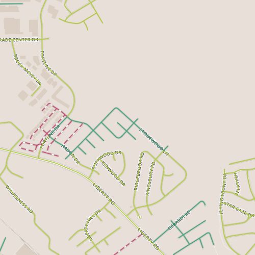
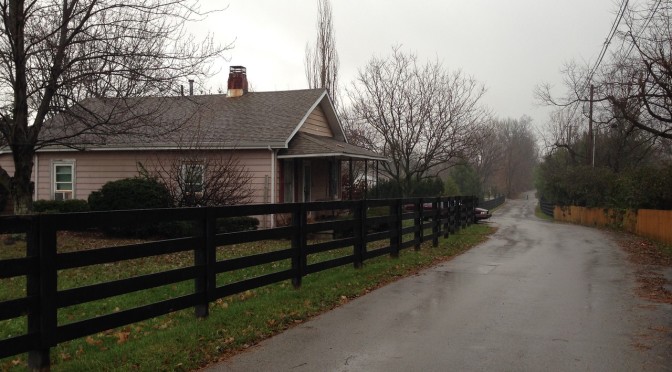
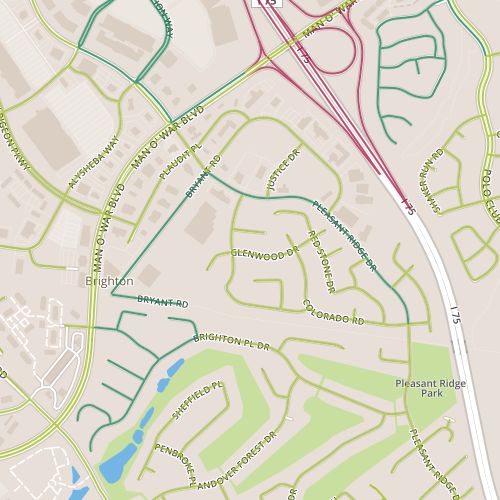
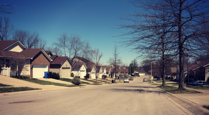
Today brought me to the Liberty Hills subdivision, just off Liberty Road and outside of New Circle Road.  This is a fairly typical 1990’s neighborhood.  Not a single street connected to any other street more than once, so I had to walk up and down each street.  The cul-de-sacs here are huge (I suppose they had to be built to handle a significant number of cars turning around) and resemble lollipops.

Side yard in the Liberty Hills subdivision.

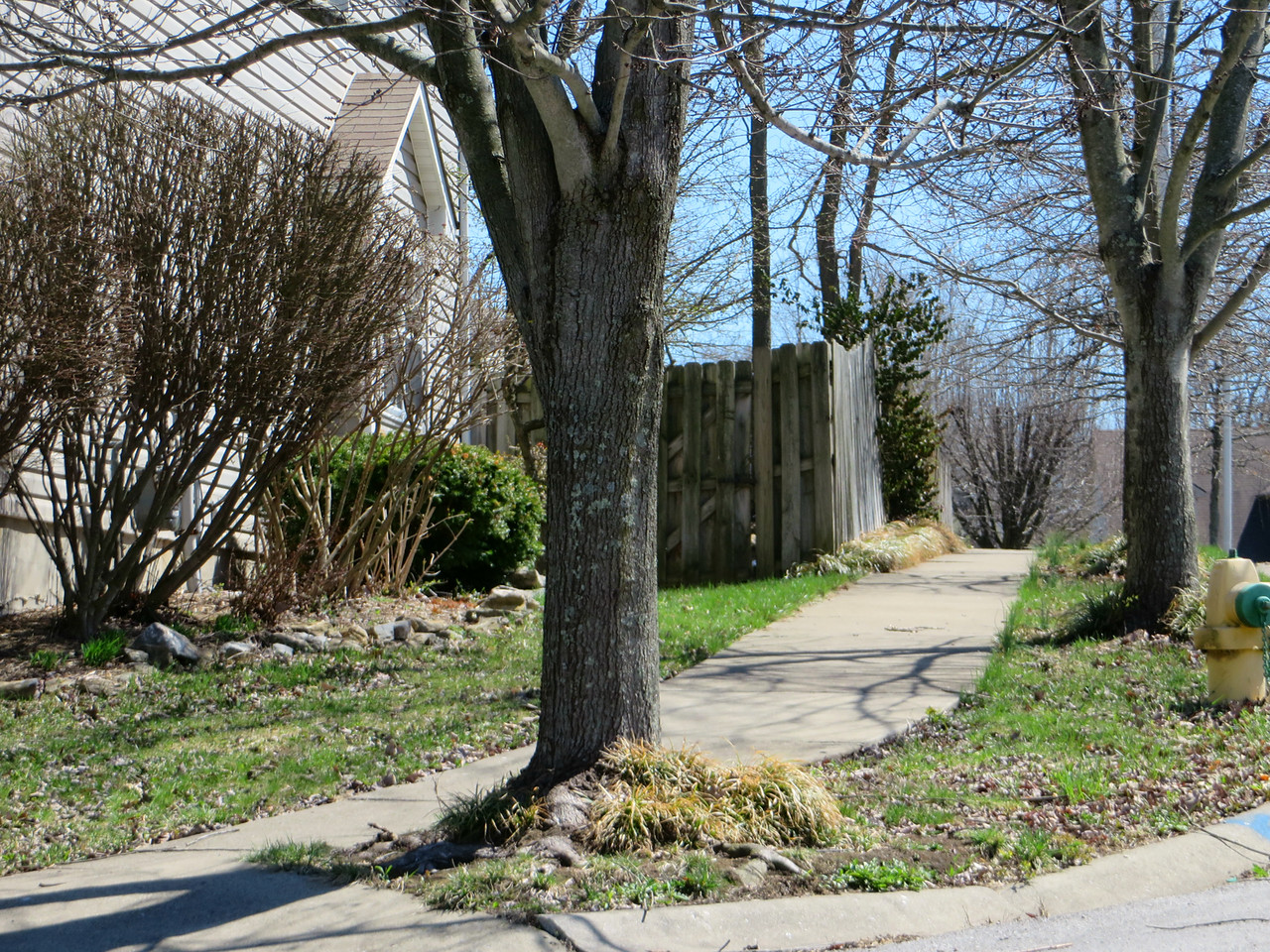
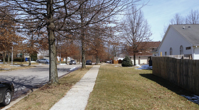
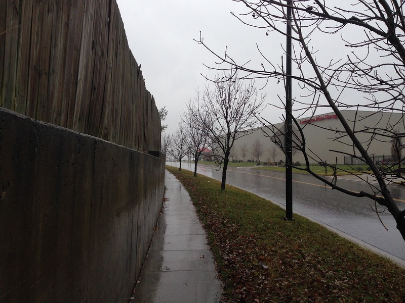
My gripes about street layout aside, this is a pleasant subdivision, with nice streetscapes and nice people.  There were a  few specific things that made it particularly nice.  As is often the case, the presence of trees in the tree lawn makes a big difference.  But there is a lot of texture in this neighborhood.  One nice example of this is the side yard and sidewalk pictured here. The side yard is set back further than the fence behind it.  Both the fence and the yard have texture too, in the form of a vine and landscaping respectively.  There are variations in both horizontal and vertical planes.  Beyond providing an example of how variations create a more interesting space, it also provides an example of how we can impact spaces after developers have left.

Day 84-Hibernation

day 84Today was my first day back on the pavement in awhile as travel, viruses and weather have conspired against scheduled walks.  I spent it in the Eastwood neighborhood, near Liberty road and next to the large Gatton property.  This is a 1990’s era neighborhood and very similar to  a lot of smaller developments near it and off of Liberty Road.

Two aspects of today’s walk were notable.  First, though most of the snow that fell last week has melted off the sidewalks, there are still little snow walls or pillars made by shoveled snow from driveways and sidewalks.  In some cases, the snow wall covered the sidewalks, revealing that some people may have shoveled their driveways but not their sidewalks.  Ahem.  The second aspect is that familiar phenomenon in which a spring-like day brings people out.  Despite the sogginess of the melted snow on rain-saturated ground, people were in their yards or out walking.  Good to see.

It’s perhaps worth a quick mention.  The time off was not all for naught.  I’ve made some tweaks to the map, with more perhaps to follow.  I’m also much closer to providing dynamic maps for each post that should better highlight each day’s walk as well as allow more context.

Day 77-Small homes and a large campus

day 77Today took me through a short stretch of high density residential next to some larger parcels including the Ashland Oil Company headquarters campus. It also featured one of the less exciting stretches of Man O’ War.  There isn’t much to surprise here.  I did spot one of the nicer phone company buildings I’ve ever seen.  Instead of the usual windowless box, this building has a hip roof and faux windows to make it less foreboding.

A disguised phone company building at Palumbo and Darby Creek.

The apartments and townhomes are 1980’s vintage and are nondescript. (Did you know there was an apartment complex along this stretch of Man O’ War?  It surprised me!)  Our aesthetics change, and apartments from this era have been impacted particularly negatively by this.  But one complex does a nice job creating a “neighborhood” feel with relatively short setbacks and a consistent presentation toward the street (unlike some of the apartment buildings, which are loosely arranged in space.

Townhomes near Palumbo and Darby Creek

Day 68-Multiuse driveway

day 68Today’s walk encompassed some of the larger commercial properties on the south side of the Hamburg area, along Bryant and Pleasant Ridge, as well as a portion of the Timber Creek neighborhood near Pleasant Ridge park, as well as a portion of the Brighton East “rail trail” connecting those two pieces.

The portion along Bryant is generally warehouse-sized commercial–large gyms, a furniture outlet.  There are also a few odd homes in here, holdouts, perhaps.  Some of these lots front the newer mixed-used trail; a sign at the entrance to the trail (the “elbow” of Bryant) states “authorized vehicles only” are allowed to pass.  Apparently homeowners are authorized!  The trail itself is part of the first “Rails to Trails” project in Lexington, completed in 2006.  These projects seek to convert existing railroad right-of-ways to mixed-used trails.  Currently there are a lot of short segments like this, but a little investigation shows that there are plans in place to extend and connect the trails.

Concrete Retaining Wall along Pleasant Ridge

I was excited about this walk, mainly for the chance to incorporate a trail–perhaps a little too eager to take it on.  I thought I’d caught a break in the rainy weather and would have a chance to walk in relatively light rain; instead, I spent most of the walk in steady downpour.  One of the neat things about this process is that I’m rediscovering walking the joys of walking in all sorts of weather, but this really depends on being dressed appropriately, and today I was not.  This will serve as a reminder to bring a raincoat.  At any rate, by the time I reached the residential segment of the walk, I was less focused on observation and more focused on moving quickly.  This stretch consists mainly of the back of houses, blank space that often occurs in suburban neighborhoods along feeder routes like Pleasant Ridge that serve to channel traffic out of neighborhoods to larger streets.  This kind of space is usually neglected, but here the area was clean and well maintained.  I think some decoration along a short concrete retaining wall could add something.

Day 66-Blacktop

day 66Today, I went by townhouse-style condominiums in the Hamburg Farms area.  These are a relatively recent addition to the landscape; it looks like construction in this area completed in 2008.  There isn’t a lot to say about this area; this entire trip was contained withing the complex.  I’ve mentioned the parking woes of dense suburban housing before.  The issue here is solved by paving space that in other complexes would have been (for better or worse) greenspace; at the time I walked through there were plenty of available parking spaces but very little green.

This is a good time to work in a note about the dataset.  I’m using street data from the Lexington GIS Open Data “portal” to define streets (and I’ve mentioned before, ideally I’d like to add in trails as well).  In some cases, driveways in apartment complexes or shopping centers that are clearly private are in the data set (and maintenance responsibility is identified as private).  In other cases, these driveways are not included.  The end result is that not everything that looks like a street is a street, and some things that don’t look like streets are.  The latter is the case in Hamburg Farms; these alleys look nothing like streets.  Though they are named, it’s clear they belong to the complex.

The alley behind the townhomes.