Tag Archives: Clays Mill

Day 75-More different than alike

day 75
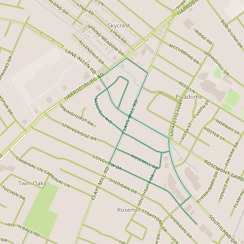
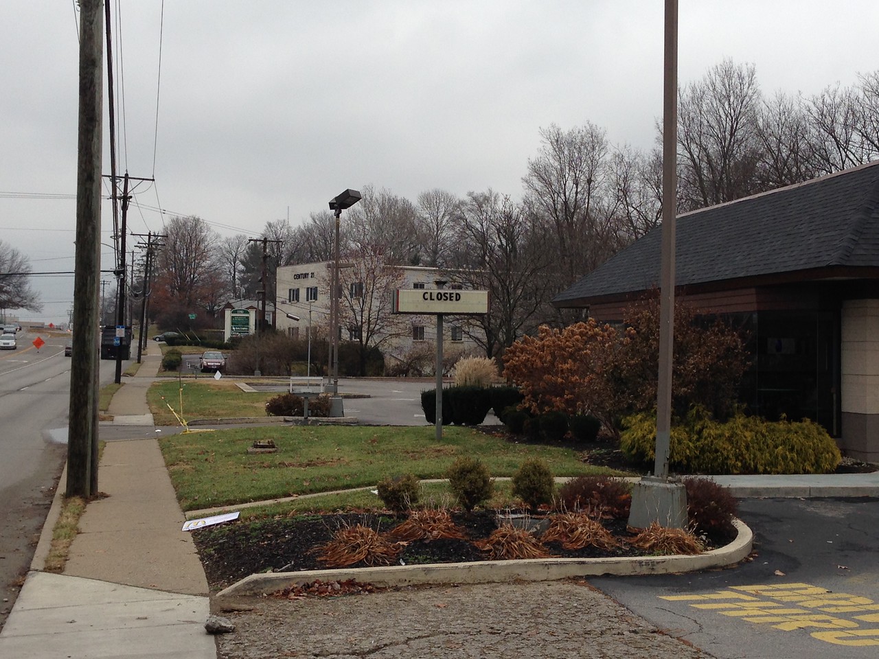
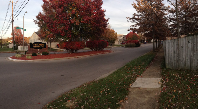
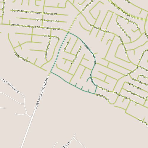
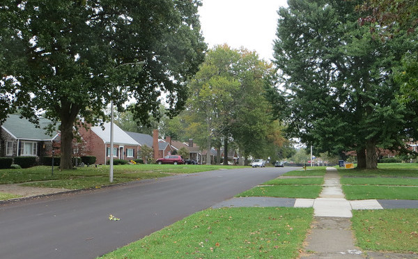
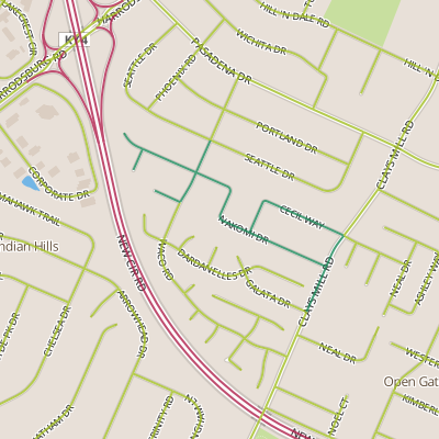
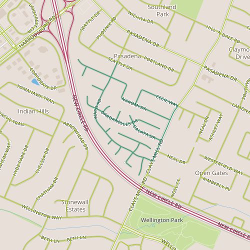
Today, I toured the Pera Place neighborhood.  This area seems to be two fairly distinct areas.  The northern area was built out in the 1980’s, the southern area in the mid 1990’s.  The northern area is interesting in that the architectural style is visually right in between the ranch styles popular in Lexington neighborhoods built in the 1960’s and 70’s and the styles that are present in neighborhoods built since the 1990’s. In addition to the being newer, the houses in the southern area are smaller and a little less illustrative of the progression of housing styles.  The two sections also have different themes for the street names–Southeast European place names in the north and botanical names in the south.  With the addition of some bogeys, there are some interesting intersections–I imagine directing someone to a house near the intersection of Waco and Dardanelles!

Entry signs at the entry to this neighborhood clearly indicate that this is the Pera Place subdivision, but nearby a street signs carry the Pasadena neighborhood badge.  So, the question is, what makes a neighborhood?  As a starting point, I’d like some well-defined neighborhood boundaries.  My home city of Denver has neighborhoods nailed down pretty well, with the neighborhoods there being clearly defined.  Individuals may understand different boundaries or a different name for a given neighborhood,  but a consistent designation exists.  Departments within the city and people who live there can speak the same language.

A recently installed street light entangled with a mature tree. Did no one ask "maybe I should move this over a few feet?"
A recently installed street light entangled with a mature tree. Did no one ask “maybe I should move this over a few feet?”

This doesn’t seem to be the case in Lexington.  The Property Value Assessor’s office seems to have a comprehensive list, but the PVA-Neighborhood field is (based on my experience) probably not well-aligned with names and boundaries that Lexingtonians would recognize and may have too fine a granularity to be useful for demographic purposes.  LexingtonKY.gov has a list of neighborhood associations, but once again, this is an imperfect list with lots of room for overlap and granularity issues.  There are entries for specific addresses; Chenault Road and Chevy Chase both have entries even though Chevy Chase includes Chenault Road.  Wikipedia has an opinion, too, with a list of neighborhoods and links to an external site.  But it may well be incomplete; it doesn’t include an entry for Pera Place (and in case you’re wondering, it’s entry for Pasadena makes clear it applies only to the adjacent neighborhood and doesn’t include Pera Place.  None of these are really satisfying.  I hope I’ve overlooked a good source and someone can point me in the right direction.  Otherwise, this would be a nice gap to fill.

This still doesn’t answer the question about what makes up a neighborhood, something I reflected on while walking though these two distinct areas.  I foresee other opportunities to yank on this thread in the future, so I’ll leave it for now!

Day 67-Written in Concrete

day 67It’s hard to fix mistakes written in concrete.  I came across the words “No More” scrawled in relatively fresh concrete in the drive way of some new structures along Mitchell and behind Harrodsburg near Lane Allen, a 1950’s era commercial district undergoing significant change.  One wonders…no more what?  Is this a response to the buildings, the construction itself–no more McDonald’s?  Or to something else, a protest against police brutality or a complaint about algebra homework?  The mystery is tantalizing, and should grow as it gets older.

IMG_0241-X2
The old McDonald’s is closed.

Jack White of the Raconteurs sings “You wrote our names down on the sidewalk/then the rain came and washed ’em off/So we should write ’em again on wet cement/so maybe people a long time from now will know what we meant.”  And while he wasn’t talking about streets and buildings, it’s interesting to try to put that meaning to it.  The messages we put in concrete today, in the form of roads and buildings, will be with us for generations.  Walking through this 1950’s neighborhood, it’s tough not to think about how society’s preferences–choices made 60 years ago–are reflected in the streetscape, and wonder what the new structures say about us.

Day 57-Small town feel at the edge of the city

day 57Today took me to the Copper Trace neighborhood (really, a collection of several subdivisions including Wyndham Ridge), along the Fayette/Jessamine border near the point where Clay’s Mill Road crosses it.  The homes in this area seem a little older than they actually are–I would have guessed the oldest houses here were from the 1980’s, but they seem to generally have been built in the 1990’s and early 2000’s.  Overall, the neighborhood has a pleasant aesthetic, with tree-lined  streets and lot sizes that aren’t really “cozy” but which aren’t wide open either.  I’m all about subjective impressions, and this area (especially the portions along Weber) didn’t feel so much like a neighborhood in a city the size of Lexington as a neighborhood in a much smaller town.

Beyond the small-town feel provided by the streetscape,  the most notable aspects of this area are related to it’s proximity (like the walk on Day 50) to the county border.  Some houses on Weber back to the county border which is pretty clearly delineated here with houses on one side and agricultural land on the other.  Besides the striking visuals of tract homes next to open space, this also provides some auditory sense of distance with the noise from some far away arterial that probably would be dampened in a neighborhood further from the edge of the city.  This portion of Clay’s Mill is probably one of the loneliest stretches of sidewalk I’ve encountered, with a long stretch behind the backs of houses and especially with traffic pouring out of the city at the end of the day.

Day 46-Car Culture meets the Co-op

day 46Today took me to an area near Southland Drive, an area that figures prominently in my mental map of the city.  This segment of Southland has several businesses that the people in my circles talk about: a particular bar, a food co-op, a Habitat Re-store.  It’s also the location of a new public health clinic currently under construction, news of which percolates up fairly regularly.  Southland always surprises me; for some reason the fact that it is essentially a collection of 1950’s era strip malls catches me off guard; it doesn’t jibe with the image in my head of a hip area.

Mr. Suds laundromat on Southland Drive

But in fact, no one has ever really said that Southland is hip.  Maybe it would be more accurate to say it is funky without being pretentious.  I came across a tattoo parlor, more than one drive through liquor store, a Caribbean store and a laundromat called “Mr. Suds.”

I was intrigued, too, by the neighborhood behind Southland Drive.  What would it be like to have your neighborhood grocery store be a co-op?  The neighborhood matches the commercial district, featuring houses from the 1950’s along car-ready streets. The perceptual contrast of small  houses along wide streets with tall trees is tough to reconcile.   Things feel as if they are going by slowly, kind of like the feeling you might get trying to run after riding a bicycle. The houses are generally similar Cape Cod style houses, though construction varies.  Houses on Mitchell and Rosemont Garden are more likely to be brick, in other places they are probably frame.  As we get closer to election time, it’s becoming easier to gauge a neighborhood’s general political leanings, and this area appears to lean to the left, with several homes sporting multiple yard signs for Democrats.  It also has a funkiness that mirrors the strip malls, an intentional shagginess that contrasts with the clean-cut yards of, say, Rookwood, but without looking neglected.

Another Lexington Art Horse

What works: The relationship between the commercial district and residential areas appears strong.

What doesn’t: Seriously, there are no sidewalks on Southland?

Day 21

Day 21This was a quick walk through another quiet neighborhood officially called Twin Oaks, located between Clay’s Mill Road and New Circle Road.  Though connected and officially part of the same neighborhood, I passed through two distinct areas (to make things more confusing, the dividing line is not a particular street but actually happens mid-block).  The first evidence of a change is that the newer subdivision, located on the New Circle Road side, does not have sidewalks while the older one, on the Clay’s Mill side, does.

The older neighborhood is comprised of homes built in the 50’s or 60’s, the newer neighborhood is newer enough to be recognizably newer, but is more typical of late 70’s and early 80’s construction.

The older neighborhood was certainly old enough to be stable, boring but in a good way.  The newer neighborhood, too, was quiet, unremarkable but very comfortable.  My thoughts while walking through this neighborhood were focused on the architecture (internally wishing I understood better or had the vocabulary to describe why a house strikes me as being from a particular time) and on the paving techniques (many driveways have been resurfaced with asphalt).

Good: Quiet, despite major roads on each side.

Bad: Feels more distant and detached (and this could be good or bad, depending on your preferences).