Day 51-Flexible Centenarians

day 51
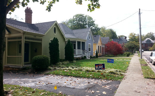
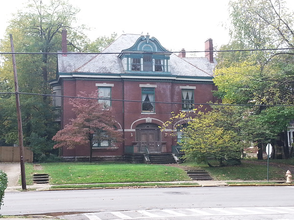
Today took me to a neighborhood officially called Douglas Heights in the Georgetown area of Lexington, an area between Newtown Pike and Georgetown street and across from the Bluegrass Community and Technical College campus.  This area is eclectic, with lots of early 1900’s shotgun houses mixed in with newer structures, some of which have served various functions over their lifetimes.  For example,  one of these buildings was converted from an apartment building into a mosque and though the congregation has since moved, it has retained the building for other purposes, naming it the “Share” center.  Other buildings now serve as stores or churches.

Painted wall in the Georgetown area.

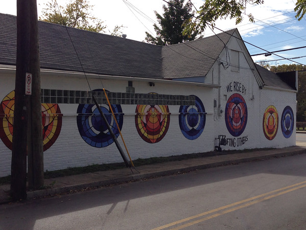
Again, this older neighborhood offers some proof that neighborhoods become more interesting as they age; there feels like a lot of variety, and not just from having buildings from a variety of eras.  Places have differentiated themselves from each other over time in more drastic and varied ways than can happen in a new neighborhood.  This area also offers a richer experience in terms of sense, more smells, more colors, though the short setbacks and narrow lots could contribute to this as well.

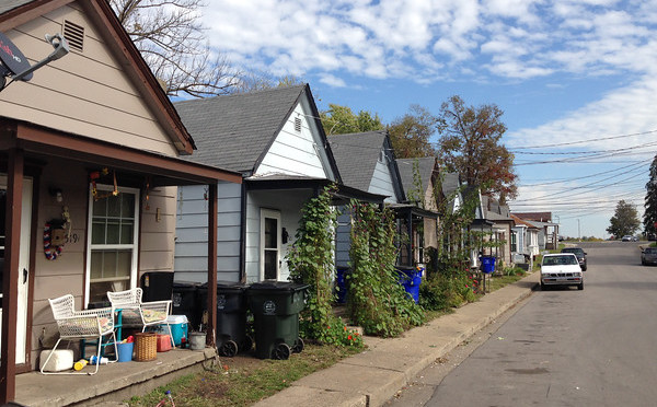
What works: this area feel cohesive, the community appears proud (streets are clean; care is taken on presentation of homes to the street.)

What doesn’t:  Lots of landlords, with a ride range in how properties are maintained.


Day 50-From hubbub to tranquility

day 50Today was spent in a neighborhood located right on the Lexington/Fayette county border with Jessamine county in an area called Sunny Slope Farms.  This is a new neighborhood, with houses ranging in age from maybe five years old to not-yet-built.

There are a few surprises.  One is that you can get very close to the electrical substation here.  The substation provided a droning hum that was surprisingly loud nearby and remained audible for most of my walk.  The power lines radiating from the substation require clear ground underneath, so this provides some greenspace through the neighborhoods.  Less of a surprise but also noisy, the CSX tracks run behind this neighborhood.  A northbound train passed by and sounded it’s whistle for the crossing at Waveland Museum just as I was passing by; not ear-splitting but loud.   Though I’ve learned from experience you get used to blocking out the sounds of these trains passing by.

Looking across the Fayette county line from the Sunny Slope neighborhood.

My second surprise was at the end of Loblolly Lane, essentially the City/County border.  And though I knew before hand that the Jessamine side of the county line here was still agricultural land, the peacefulness of the view was still quite a contrast from the noise of the substation and train.  And I can imagine having this view from your backyard or at the end of the street would make up for a little noise.

Small cemetery in the Sunny Slope neighborhood

A final surprise was a small fenced area with a sign indicating a cemetery.   The fence encircled an overgrown area not visually much different than the area around it–there were no visible grave markers of any kind.  Perhaps a relic of the area’s not-to-distant past

What works: There are some tranquil places here.

What doesn’t: Some of the noise is inescapable.

Day 49-Going by slow

day 49A song from a band called Poi Dog Pondering captured my attention a long time ago with a song about walking even when other alternatives were available.  The song’s conclusion, that “you get to know things better/when they go by slow,” has been among the motivators for this project.  Today’s walk was along a stretch of one of Lexington’s spoke arterials, Harrodsburg Road, which takes traffic from downtown to Jessamine county, Nicholasville and points beyond.  This particular stretch is not slow; there aren’t many reasons to slow down.  There are a few feeder routes into neighborhoods and a shopping district at the corner of Man O’ War and Harrodsburg, but none of these have ever drawn significant enough traffic to slow down this drive.

Signage for Palomar Centre at Man O'War and Harrodsburg
Signage for Palomar Centre at Man O’War and Harrodsburg

It’s not, at the first glance, a terribly exciting route, but it’s the first in what I expect will be a series of trips down arterials that are necessitated by low density of connected feeder routes along them.  That is, in many cases it is difficult to find an efficient loop that would be short enough for me to walk.  Compare this to my routes along Winchester Road, a similar spoke arterial, but one that intersects smaller streets much more frequently.  At any rate, planning this route was a little like making sure there was some broccoli on the menu.

Hidden mansion along Harrodsburg

The potential payoff was really from watching it go by at three miles per hour instead of 55.  And  I did see a few things I wouldn’t have otherwise, including, hidden among the trees, a large mansion built in 1851.  The wooded areas on either side provide might provide some adventure for the right people, ambitious kids or geocachers, maybe and there were a couple of other unusual properties as well.  Would I walk this stretch of Harrodsburg again?  Probably not, but sometimes you do things just so you can say you did it.

What works: This stretch of road is good at what it does.

What doesn’t (for my purposes, anyway): What it does has nothing to do with people travelling on foot.

Day 48-Townhomes…and Townshops

day 48I ran into a little bit of fall rain during today’s walk in the Patchen Woods subdivision just southeast of Richmond Road and just outside of New Circle Road.  Overall, it was a nice enough day for walking, with the rain and gray sky bringing out some of the fall color.  I passed through several different areas here, with single family homes, attached homes, apartments and commercial space sharing a relatively short stretch of Patchen Drive.

Fall color on Chippendale Circle

Perhaps my favorite surprise was finding a real alley in this relatively new (1980’s era) neighborhood, an alley that allows not only trash collection but also car storage to be hidden by the houses on either side.  The entire residential area along Chippendale is pleasant.  The mature trees and tall brick facades of the houses give this block a rich feel, but even the portions alongside apartment buildings feel welcoming in a way that apartment complexes usually don’t.  There are other apartments along this stretch of Patchen that are more forgettable, but the scale never feels overwhelming, possibly because none of these complexes have parking lots along the street.

The commercial areas don’t follow this a strictly (parts of Gribbin are faced with parking lots) but the shopping complexes here are probably somewhat unique in their design.  Parking is located along two sides of the complex and on-street parking is available on a third side.  But many of the businesses don’t face the parking lots and some are located on the inside of the complex.  So on a day like today, customers have to walk in the rain for a short distance.  (And of course, they would anyway!)  It was refreshing to see commercial property that allows people to realize they won’t melt if they don’t go directly from paved parking lot to conditioned space.  A second interesting aspect of this area is that the complex buildings look a lot like apartment buildings.  I wonder if they were planned as apartments originally and converted to  commercial space to meet changing demand, though they’re not the only commercial spaces with a strong residential appearance in Lexington.

What works: Human scale helps create a strong connection through the neighborhood to commercial districts along Patchen and Richmond.

What doesn’t: Richmond is so car-oriented, it doesn’t really matter.

Day 47-Divided on the Mayor

day 47Today took me to the neighborhood near West Sixth and Broadway.  This stretch of Broadway is a commercial corridor, and the neighborhood sits behind it.  It’s an older neighborhood, one of the oldest I’ve seen so far, with many houses dating to the first decade of the 20th century.  There were also some gaps, vacant properties that probably won’t stay undeveloped for long.

As this is the season of yard signs, one thing stood out to me.  This area appears to be split geographically in terms of energized support for the two mayoral candidates, with the older portions to the south and west favoring the incumbent Jim Gray and the (slightly) newer portions supporting the challenger Anthany Beatty.  One could come up with plenty of reasons for this, and it could be a fluke.  I do think Beatty’s campaign slogan is worth some thought.  He claims he will be  “Mayor of ALL of Lexington,” leveling criticism at Gray that he is too focused on the downtown areas at the expense of the suburban and rural parts of the city.  I think it’s a good slogan, getting right to the heart of the problem that planning-oriented or big-project mayors have.  Attention on big projects or urban centers can appear to neglect major portions of the city, and even stakeholders in areas of focus if development may change neighborhood character.

Early 1900's house on West Sixth St.
Early 1900’s house on West Sixth St.

Appearing to neglect and actually neglecting are different things and campaigns rarely have time for nuance.  But Beatty’s signs are pretty widespread throughout Lexington and it’s easy to believe the residents of this area have a good reason to support him.


What works:  This appears to be a cared-for area with character.

What doesn’t: It may be a neighborhood trying to go in  two different directions.